- التسوق ، اصبح سهلا.
- /
- احصل على التطبيق!
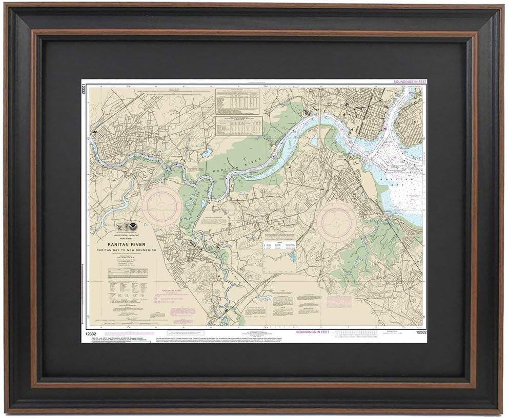
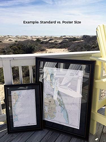
Raritan River, NJ NOAA 12332. This Framed Nautical Map covers the waterway and banks of the Raritan River from New Brunswick to the Raritan Bay. The Framed Nautical Chart is the official NOAA Nautical Chart detailing Raritan River; including parts of New Brunswick, Perth Amboy, Staten Island, and Raritan Bay. NOAA Nautical Chart 12332. Standard frame is approx 19" H x 24" W. Poster frame is 29" H x 36" W. Solid Hardwood Frame, Glass Front, Black Mat, Paper Duster Backing with Wire Hanging, Handmade in USA.
 قميص روبيز الرجالي Nightmare On Elm St Freddy Krueger مع قناع
SAR 96
قميص روبيز الرجالي Nightmare On Elm St Freddy Krueger مع قناع
SAR 96
 بطانة قبعة شتوية صلبة من Ergodyne N-Ferno 6850 - طبقتين، مبطنة بالصوف، غلاف قطني، طول عادي
SAR 14
بطانة قبعة شتوية صلبة من Ergodyne N-Ferno 6850 - طبقتين، مبطنة بالصوف، غلاف قطني، طول عادي
SAR 14
 السجاد الشرقي في صورة مصغرة: تصاميم مخططة للتطريز أو ما شئت
SAR 110
السجاد الشرقي في صورة مصغرة: تصاميم مخططة للتطريز أو ما شئت
SAR 110
 10 قطع من حقيبة Yayatty المصنوعة من جلد البولي يوريثان، حقائب كروشيه حياكة بيضاوية سفلية مع فتحات لحقيبة اليد DIY وحقائب الكتف ومستلزمات صنع المحفظة
SAR 89
10 قطع من حقيبة Yayatty المصنوعة من جلد البولي يوريثان، حقائب كروشيه حياكة بيضاوية سفلية مع فتحات لحقيبة اليد DIY وحقائب الكتف ومستلزمات صنع المحفظة
SAR 89