- التسوق ، اصبح سهلا.
- /
- احصل على التطبيق!
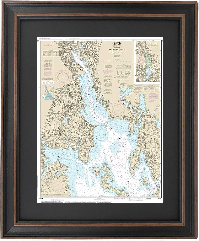
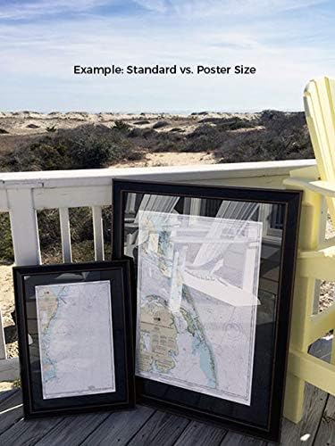
Providence River (Head of Narragansett Bay) 13224. This Framed Nautical Map covers the waters and coast line of Providence River (Head of Narragansett Bay) including the Seekonk River from Cold Spring Point to Pawtucket. The Framed Nautical Chart is the official NOAA Nautical Chart detailing the beautiful waters of the Providence River and Head of Narragansett Bay; including Greenwich Bay, Prudence island, Providence, East Providence, and other towns and harbors..Product Details: NOAA Nautical Chart 13224. Standard Frame is 17" H. x 24" W. Poster frame is 25 3/4‚ H x 36" W. Solid Hardwood Frame, Glass Front, Black Matte, Paper Duster Backing with Wire Hanging, Handmade in USA
![[منطقة الراحة] سائل سامي سكين للرقبة والصدر، كريم لشد الرقبة والصدر، خفيف الوزن وسريع الامتصاص، مثالي للبشرة الناضجة والجافة، 2.02 أونصة سائلة. أوز. in Saudi Arabia](https://cdn1.tilga.com/md/prod/1/674/3/28078239.14503.jpg) [منطقة الراحة] سائل سامي سكين للرقبة والصدر، كريم لشد الرقبة والصدر، خفيف الوزن وسريع الامتصاص، مثالي للبشرة الناضجة والجافة، 2.02 أونصة سائلة. أوز.
SAR 512
[منطقة الراحة] سائل سامي سكين للرقبة والصدر، كريم لشد الرقبة والصدر، خفيف الوزن وسريع الامتصاص، مثالي للبشرة الناضجة والجافة، 2.02 أونصة سائلة. أوز.
SAR 512
 فروج توغز، مناشف التبريد ذات الوسادة الباردة، عبوتان، 33 بوصة × 13 بوصة
SAR 105
فروج توغز، مناشف التبريد ذات الوسادة الباردة، عبوتان، 33 بوصة × 13 بوصة
SAR 105
 فرك الصدر المهدئ بالأوكالبتوس من بابو بوتانيكالز - عضوي من وزارة الزراعة الأمريكية - راحة مهدئة مع زيوت الأوكالبتوس واللافندر وإكليل الجبل العطرية - مصنوع بدون الكافور أو البترول - للأعمار من 3 سنوات فما فوق.
SAR 74
فرك الصدر المهدئ بالأوكالبتوس من بابو بوتانيكالز - عضوي من وزارة الزراعة الأمريكية - راحة مهدئة مع زيوت الأوكالبتوس واللافندر وإكليل الجبل العطرية - مصنوع بدون الكافور أو البترول - للأعمار من 3 سنوات فما فوق.
SAR 74
 ملك المجد
SAR 112
ملك المجد
SAR 112