- التسوق ، اصبح سهلا.
- /
- احصل على التطبيق!
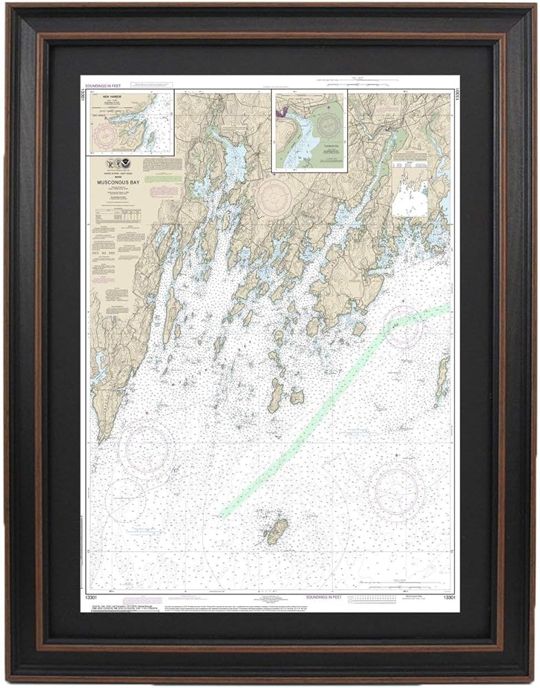
Muscongus Bay, Maine NOAA 13301. This Framed Nautical Map covers the waterways around Muscongus Bay, Maine. The Framed Nautical Chart is the official NOAA Nautical Chart detailing the beautiful waters off of the Maine Coast. NOAA Nautical Chart 13301. Standard frame is approx 24" H x 18" W. Poster frame is approx 36" H x 29" W. Solid Hardwood Frame, Glass Front, Black Mat, Duster Backing with Wire Hanging, Handmade in USA.
 12 قطعة ليتس جو جيرلز مجموعة حقائب الحفلات بتصميم غربي كاوجيرل هانغوفر حقائب الاستشفاء مع الرباط الرباط الوردي الساخن لحفلات الزفاف حفلات الزفاف لوازم حفلات توديع العزوبية 5.9 × 7.9 بوصة
SAR 68
12 قطعة ليتس جو جيرلز مجموعة حقائب الحفلات بتصميم غربي كاوجيرل هانغوفر حقائب الاستشفاء مع الرباط الرباط الوردي الساخن لحفلات الزفاف حفلات الزفاف لوازم حفلات توديع العزوبية 5.9 × 7.9 بوصة
SAR 68
 مشط إزالة القمل المعدني الفاخر ذو الوجهين من نيكس (عبوة من قطعتين) باللون الأزرق
SAR 94
مشط إزالة القمل المعدني الفاخر ذو الوجهين من نيكس (عبوة من قطعتين) باللون الأزرق
SAR 94
 -46%
التصميم والإنشاء واللحاف: كيفية تصميم اللحاف - الدروس والتقنيات والأنماط
SAR 76
-46%
التصميم والإنشاء واللحاف: كيفية تصميم اللحاف - الدروس والتقنيات والأنماط
SAR 76
 أكياس هدايا السهرة الرسمية - لرفقاء العريس، وحفلات البكالوريوس، وحفلات الزفاف - 10 عبوات
SAR 94
أكياس هدايا السهرة الرسمية - لرفقاء العريس، وحفلات البكالوريوس، وحفلات الزفاف - 10 عبوات
SAR 94