- Shopping, made easy.
- /
- Get the app!
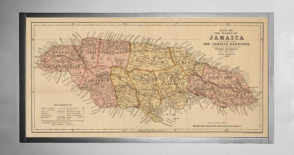
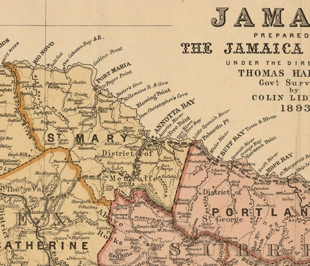
1893 Map of the island of Jamaica Also shows administrative divisions. Relief shown by hachures.
 Large Magic Practice Copybook for Kids,Handwriting Practice Book 4 Pack with Pen Refill English Cursive Calligraphy Reusable Age 3-8 ,11.4x8.3Inch (4pc+2 pen)
SAR 45
Large Magic Practice Copybook for Kids,Handwriting Practice Book 4 Pack with Pen Refill English Cursive Calligraphy Reusable Age 3-8 ,11.4x8.3Inch (4pc+2 pen)
SAR 45
 AKAYOK Storage Pocket Chart Hanging File Organizer Wall Mount, Over the Door Organizer, Wall File Organizer for office, Business, Home and School Organizers (4 Pockets)
SAR 68
AKAYOK Storage Pocket Chart Hanging File Organizer Wall Mount, Over the Door Organizer, Wall File Organizer for office, Business, Home and School Organizers (4 Pockets)
SAR 68
 Jonti-Craft 8075JC5 Tub, Clear, Pack of 5
SAR 313
Jonti-Craft 8075JC5 Tub, Clear, Pack of 5
SAR 313
 Jsehchya 120 PCS Behavior Reward Punch cards for Kids,suit for Classroom Student Awards Loyalty,Reward Customer Business Incentive Loyalty (water color)
SAR 29
Jsehchya 120 PCS Behavior Reward Punch cards for Kids,suit for Classroom Student Awards Loyalty,Reward Customer Business Incentive Loyalty (water color)
SAR 29