- التسوق ، اصبح سهلا.
- /
- احصل على التطبيق!
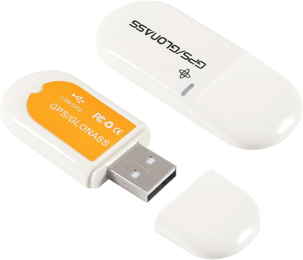
Specification:
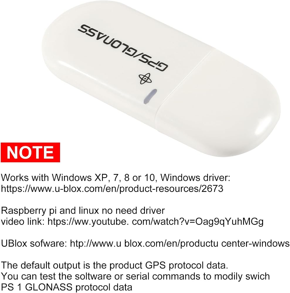
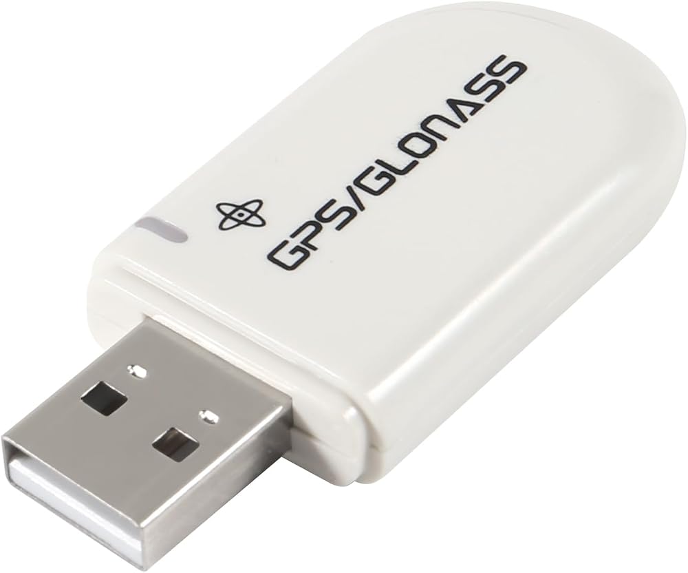
Supported Operating Systems: Windows 10/8/7/Vista/XP/CE
Support Google Earth
C/A code, 1.023MHz stream
Receive Band: L1 [1575.42MHz] Tracking Channels: 56
Support DGPS [WAAS, EGNOS and MSAS]
Positioning Performance: 2D plane: 5m [average]
2D Plane: 3.5m [average], has DGPS auxiliary.
Drift: Timing Accuracy: 1us
Reference Coordinate System: WGS-84
Maximum Altitude: 18,000 m
Maximum Speed: 500m / s
Acceleration: Tracking Sensitivity:-162dBm
Acquisition Sensitivity:-160dBm
Cold Start Time: 29s [average]
Warm Start Time: 28s [average]
Hot Start Time: 1s [average]
Recapture Time: 0.1s [average]
Operating Temperature: -30 to +80
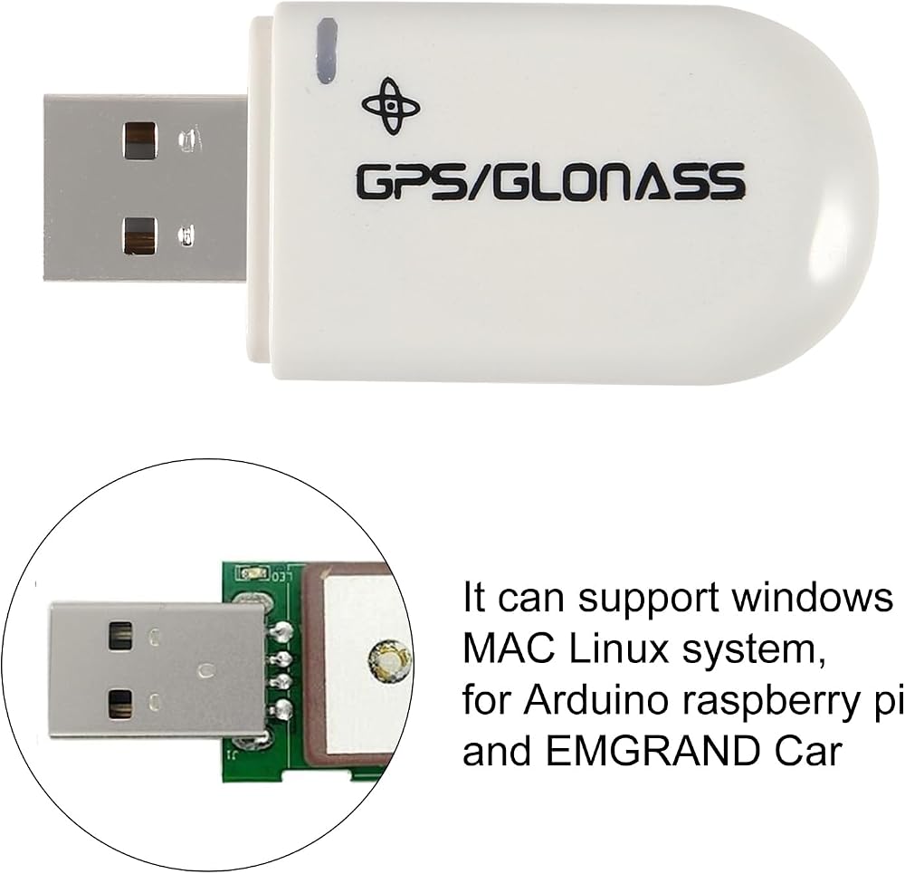
Support System:
Linux, Windows ME/98/CE, server 2003, server 2008, vista, XP, Windows 7, Windows 8,Windows 10, all windows series system.
GGA: Time, Location, Location Type
GLL: Longitude, Latitude, UTC Time
GSA: GPS receiver operation mode, positioning satellite, DOP value GSV: visible GPS satellite information, elevation, azimuth, signal-to-noise ratio (SNR) RMC: time, date, position, speed
VTG: Ground Velocity Information
 بطارية بديلة YK372731 بقدرة 280 مللي أمبير في الساعة متوافقة مع جهاز Golf Buddy Voice وVoice+ وVoice VS4 وVoice 2 Talking GPS Range Finder مع أدوات تثبيت مجانية
SAR 69
بطارية بديلة YK372731 بقدرة 280 مللي أمبير في الساعة متوافقة مع جهاز Golf Buddy Voice وVoice+ وVoice VS4 وVoice 2 Talking GPS Range Finder مع أدوات تثبيت مجانية
SAR 69
 -7%
شارجر سيتي حامل فتحة تهوية للسيارة من سيمبل لوك لمبرمج موالف السيارات سي او بي بي في 3 (يناسب جميع الفتحات الافقية والعمودية)
SAR 65
-7%
شارجر سيتي حامل فتحة تهوية للسيارة من سيمبل لوك لمبرمج موالف السيارات سي او بي بي في 3 (يناسب جميع الفتحات الافقية والعمودية)
SAR 65
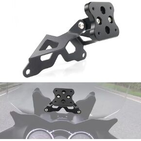 xitomer GPS Mount GPS Bracket مناسب لـ DL650 DL1 000 V-Strom 650 2004 20005 2006 2007 2008 2009 2010 2011، متوافق مع Garmin Tomtom Mount Navigator Mount
SAR 114
xitomer GPS Mount GPS Bracket مناسب لـ DL650 DL1 000 V-Strom 650 2004 20005 2006 2007 2008 2009 2010 2011، متوافق مع Garmin Tomtom Mount Navigator Mount
SAR 114
 AP Products 014-122067 قبعة واقية من المطاط
SAR 48
AP Products 014-122067 قبعة واقية من المطاط
SAR 48