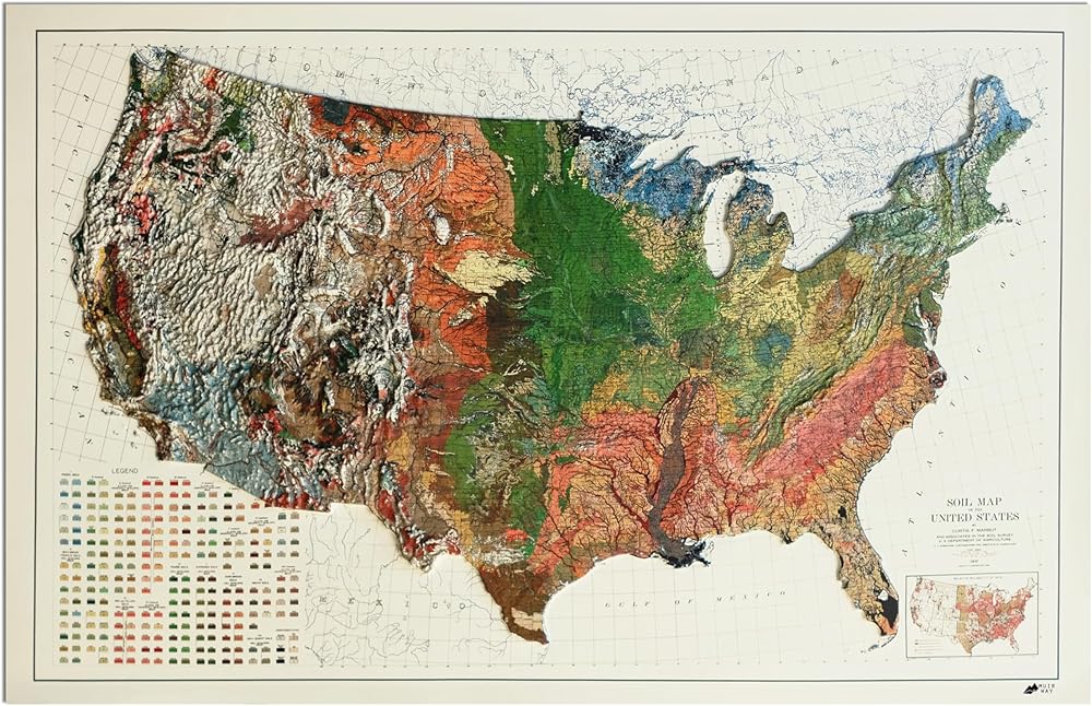
A Bold Gift That Brings USA's Landscape to Life: This sculptural map captures the elevations, contours, and character of USA in dimensional detail. Perfect for home offices, classrooms, or cabins - it's a statement piece for those who feel connected to the land.
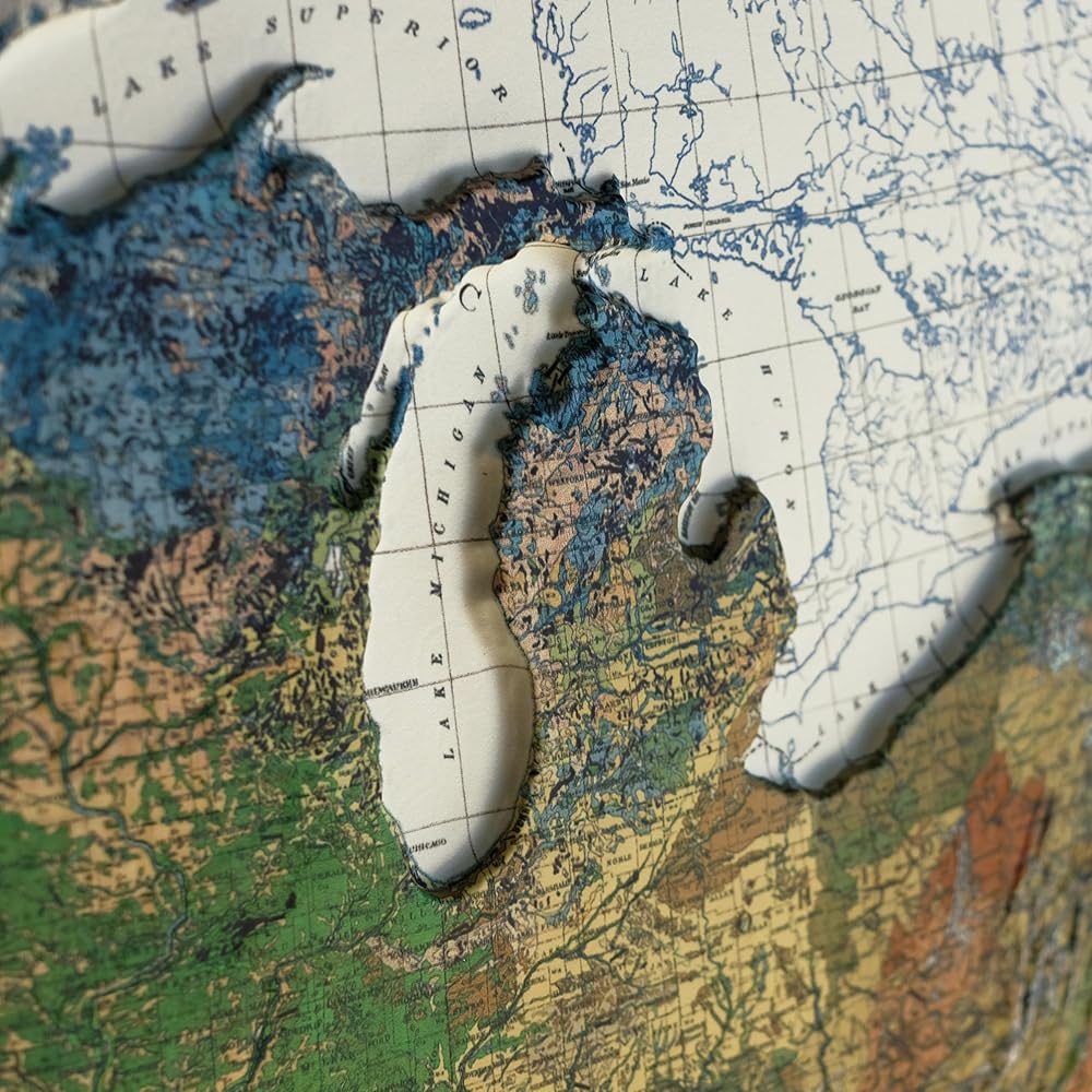
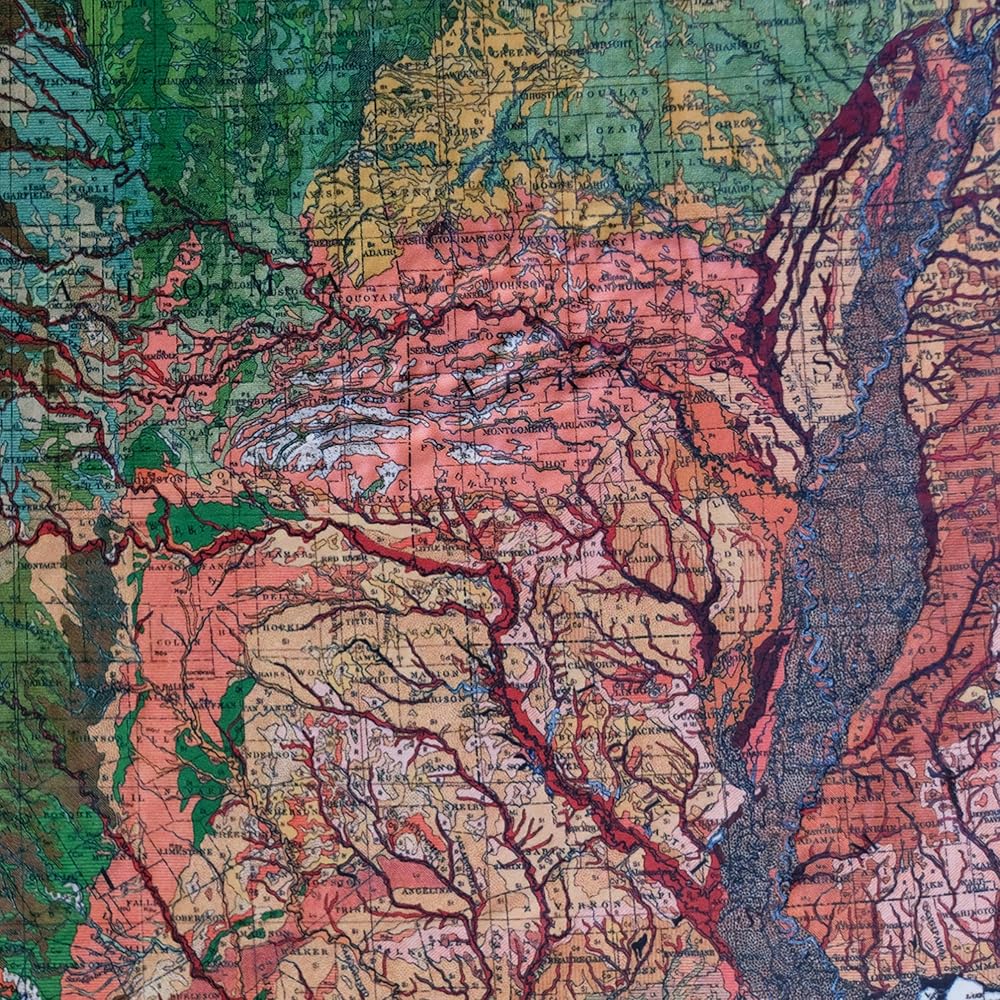
Explore the Elevation of USA: This raised relief map highlights the mountains, valleys, and terrain that define the landscape. From subtle ridgelines to dramatic peaks, every contour is captured in dimensional detail for a striking geographic perspective.
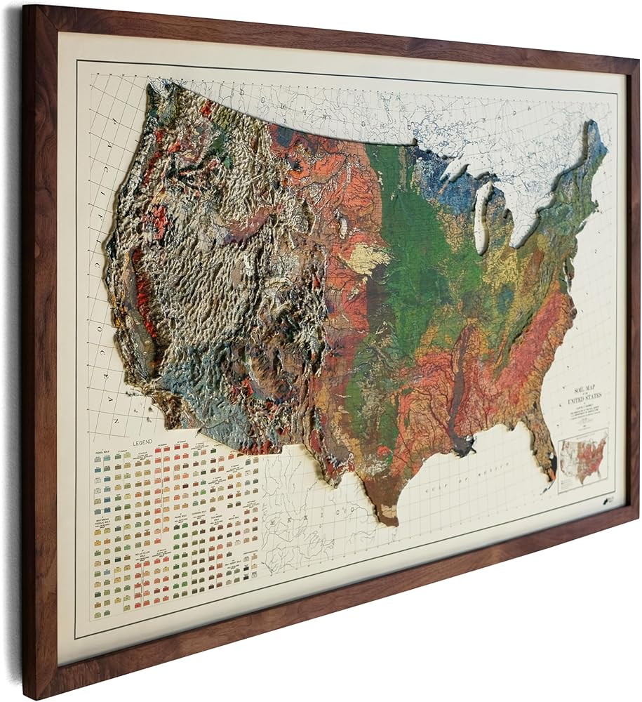
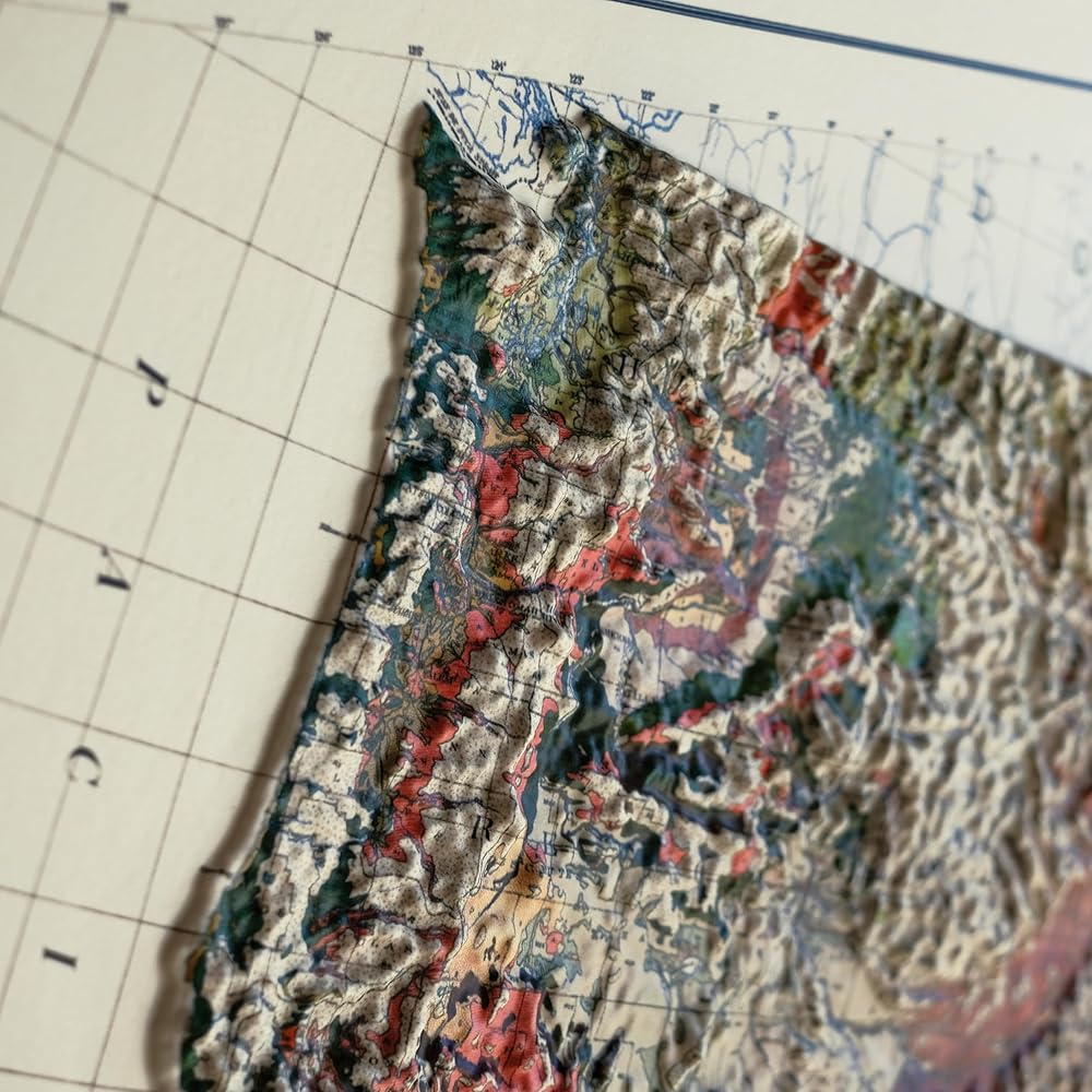
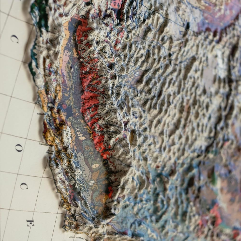
A Real 3D Map with Stunning Elevation Detail: This is not a printed illusion - it's a true raised relief map, molded in plastic and formed over precise, high-resolution elevation data. Mountains rise up to ¾–1", capturing every contour with striking clarity. It's geography you can see and feel.
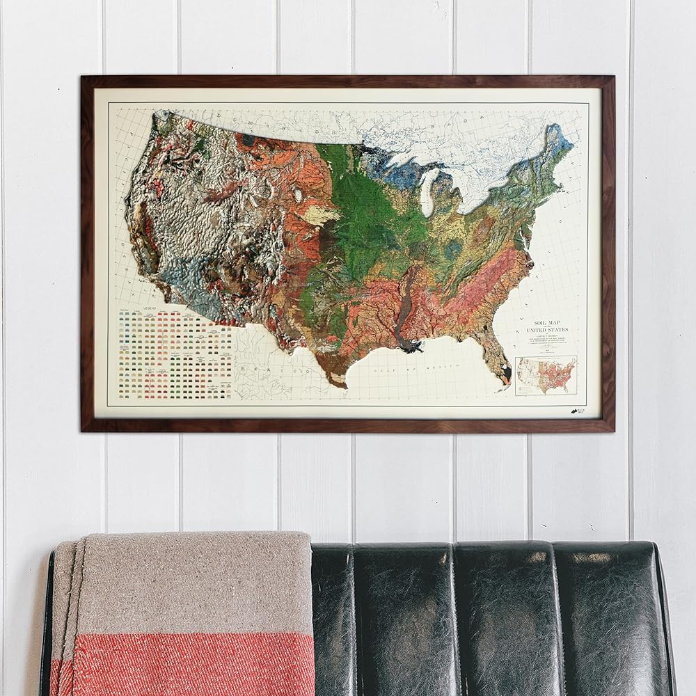
Mounted and Built to Last - Ready to Frame: Each map is thermo-formed and mounted on rigid 3/16" foam board, then trimmed for a clean, polished edge. Unlike flimsy printed maps, this piece is durable, accurate, and refined - designed for framing, display, or shelf placement without warping.
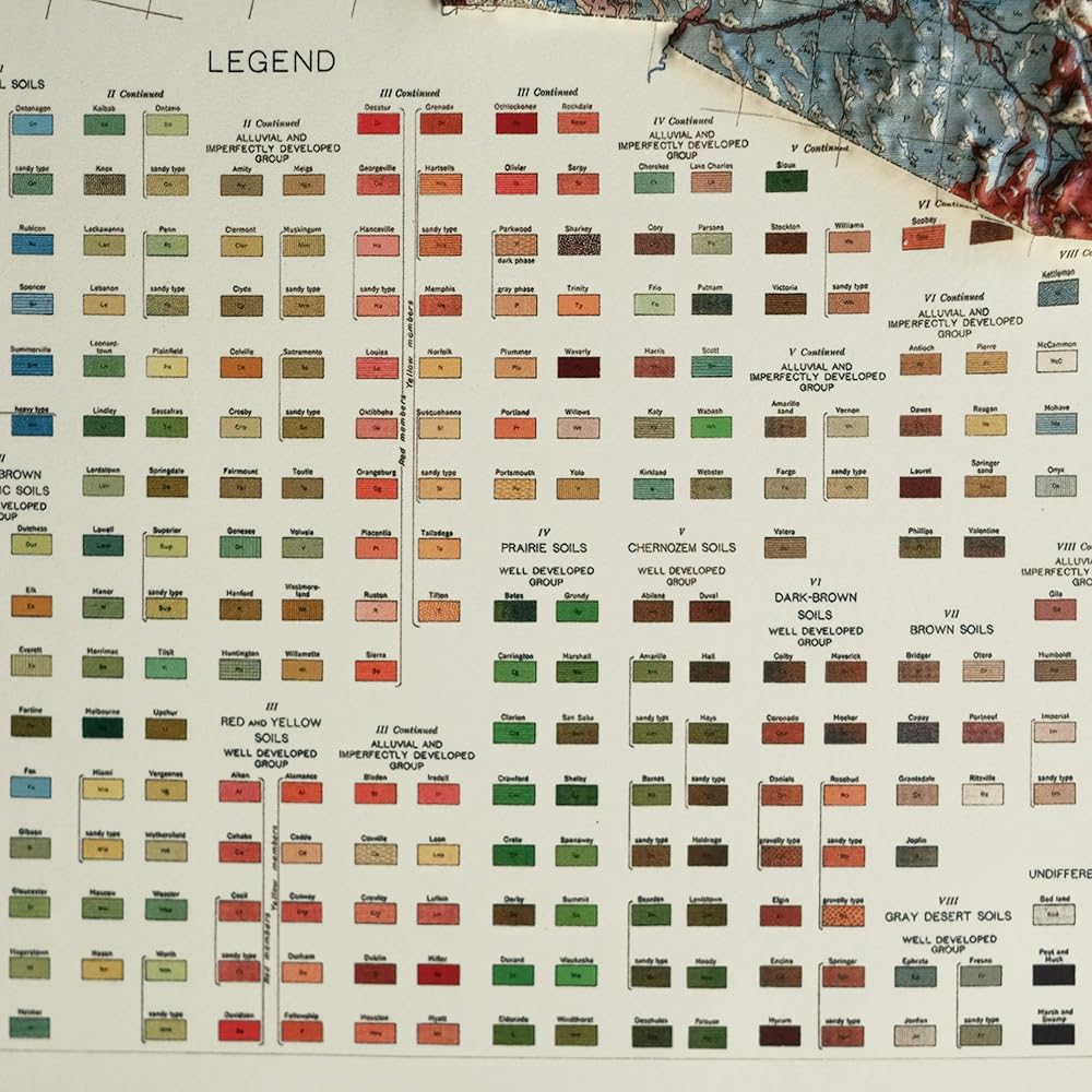
The Muir Way: Each Muir Way map is an original design that blends artistic detail with geographic accuracy. Printed in the USA using archival materials, our maps are made to last and meant to be treasured. More than just wall art, they're heirloom-quality pieces that inspire, educate, and elevate any space.


 Gold Gray Car Windshield Tint Film 70% VLT Car Window Film Tint 99.9% UV Blocking Clear Solar Window Film for Car Front Windshield Automotive Sun Protection Film, 29.52" x 118.11"
SAR 112
Gold Gray Car Windshield Tint Film 70% VLT Car Window Film Tint 99.9% UV Blocking Clear Solar Window Film for Car Front Windshield Automotive Sun Protection Film, 29.52" x 118.11"
SAR 112
 Meri Meri Magical Princess Candles (Pack of 5)
SAR 63
Meri Meri Magical Princess Candles (Pack of 5)
SAR 63
 Walnut Wood Ring Box 4 Slot Glass Lid,Wedding Ceremony Ring Bearer Box with Clear Transparent Lid, Proposal Engagement Storage for many Rings, Unique Ring Gift Box for Her, four Slots
SAR 42
Walnut Wood Ring Box 4 Slot Glass Lid,Wedding Ceremony Ring Bearer Box with Clear Transparent Lid, Proposal Engagement Storage for many Rings, Unique Ring Gift Box for Her, four Slots
SAR 42
 Modern Wall Clock, 10 Inch Digital Wall Clocks Battery Operated, Round Non Ticking Silent Analog Clock for Bedroom Living Room Kitchen Office Gym Classroom Decor,Black Battery Clock
SAR 68
Modern Wall Clock, 10 Inch Digital Wall Clocks Battery Operated, Round Non Ticking Silent Analog Clock for Bedroom Living Room Kitchen Office Gym Classroom Decor,Black Battery Clock
SAR 68