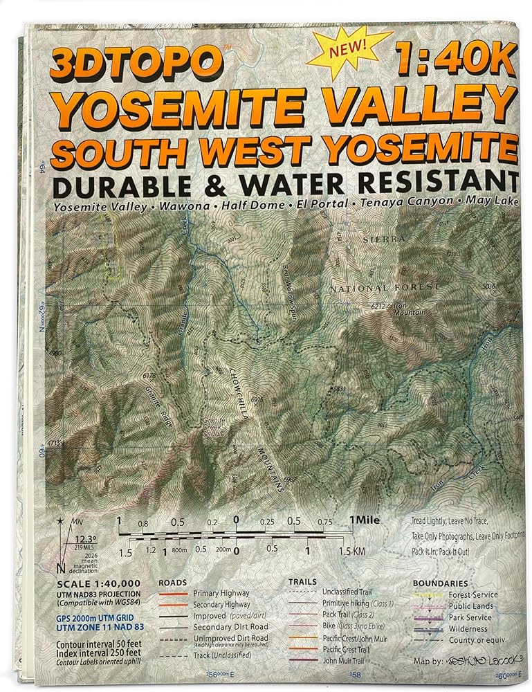
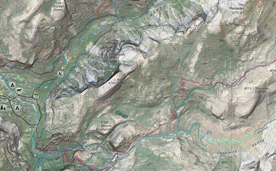
Provides exceptional detail and practical information for exploring one of America's most iconic national parks. Covers Yosemite Valley, Wawona, El Portal, Half Dome, and the Merced and South Fork Merced rivers. Built from authoritative sources including the National Park Service and regional land management agencies.
Links seamlessly with our Mount Lyell (SE Yosemite), Hetch Hetchy (NW Yosemite), and Tuolumne (NE Yosemite) maps for nearly complete national park coverage.
Recent land cover data and realistic 3D terrain shading bring the landscape to life with incredible detail, giving you an intuitive sense of the terrain before you set foot on the trail.
UTM grid makes it simple to pinpoint your location using GPS coordinates.
50-foot contours, 250-foot labeled index contours.
1:40,000 scale built from 1:24,000 scale and better data for exceptional detail.
Durable and practically waterproof: rated for 6 months of continuous outdoor use.
Features official National Park symbols such as campgrounds, picnic areas and trailheads.
Includes comprehensive trail networks, detailed hydrography, precise road classifications, lodging, food services, and more. The John Muir Trail section is highlighted throughout the coverage area, and summit and lake elevations are included for quick reference.
The 3DTOPO edition features richly detailed land cover and lifelike terrain shading for the most immersive experience. The 3DTOPO Classic edition offers a cleaner look with contour lines and features front and center; ideal for topo purists or anyone who prefers a traditional feel.


 Outdoor Trail Maps New Mexico Hiking Pack - Complete Set (2023)
SAR 261
Outdoor Trail Maps New Mexico Hiking Pack - Complete Set (2023)
SAR 261
 Colorado 14ers Complete 16 Map Pack - All 58 Colorado Fourteeners
SAR 365
Colorado 14ers Complete 16 Map Pack - All 58 Colorado Fourteeners
SAR 365
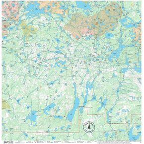 BWCA Map - BWCA 12 – Waterproof, Durable Cloth Map for Canoeing, Hiking, and Camping by True North Map Company
SAR 157
BWCA Map - BWCA 12 – Waterproof, Durable Cloth Map for Canoeing, Hiking, and Camping by True North Map Company
SAR 157
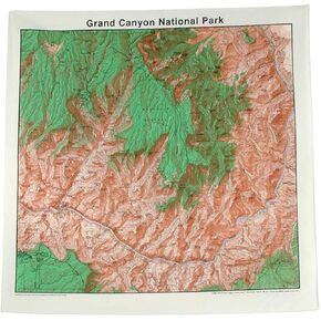 Topographic Map Bandana Grand Canyon National Park
SAR 75
Topographic Map Bandana Grand Canyon National Park
SAR 75