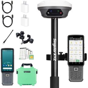
【Centimeter RTK Performance】L1-AR GNSS RTK support with1408-channel L1/L2 GNSS engine delivers 5-second initialization and centimeter accuracy under trees and urban canyons, supporting GPS/GLONASS/Galileo/BDS/QZSS/SBAS.
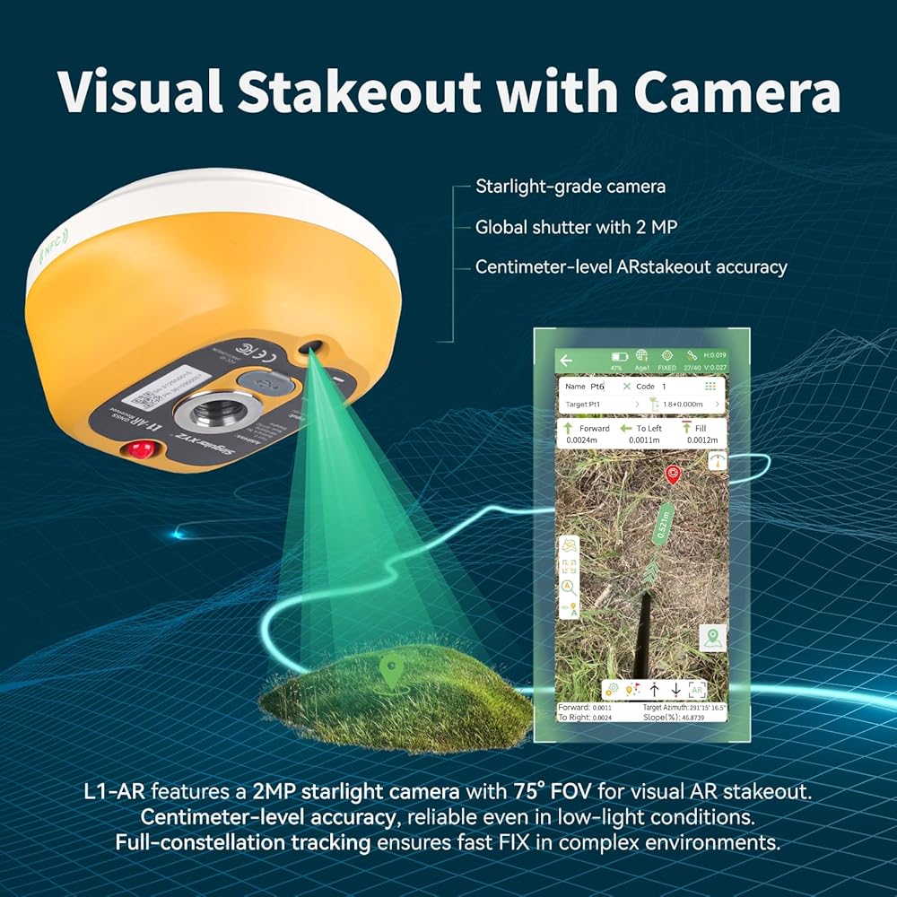
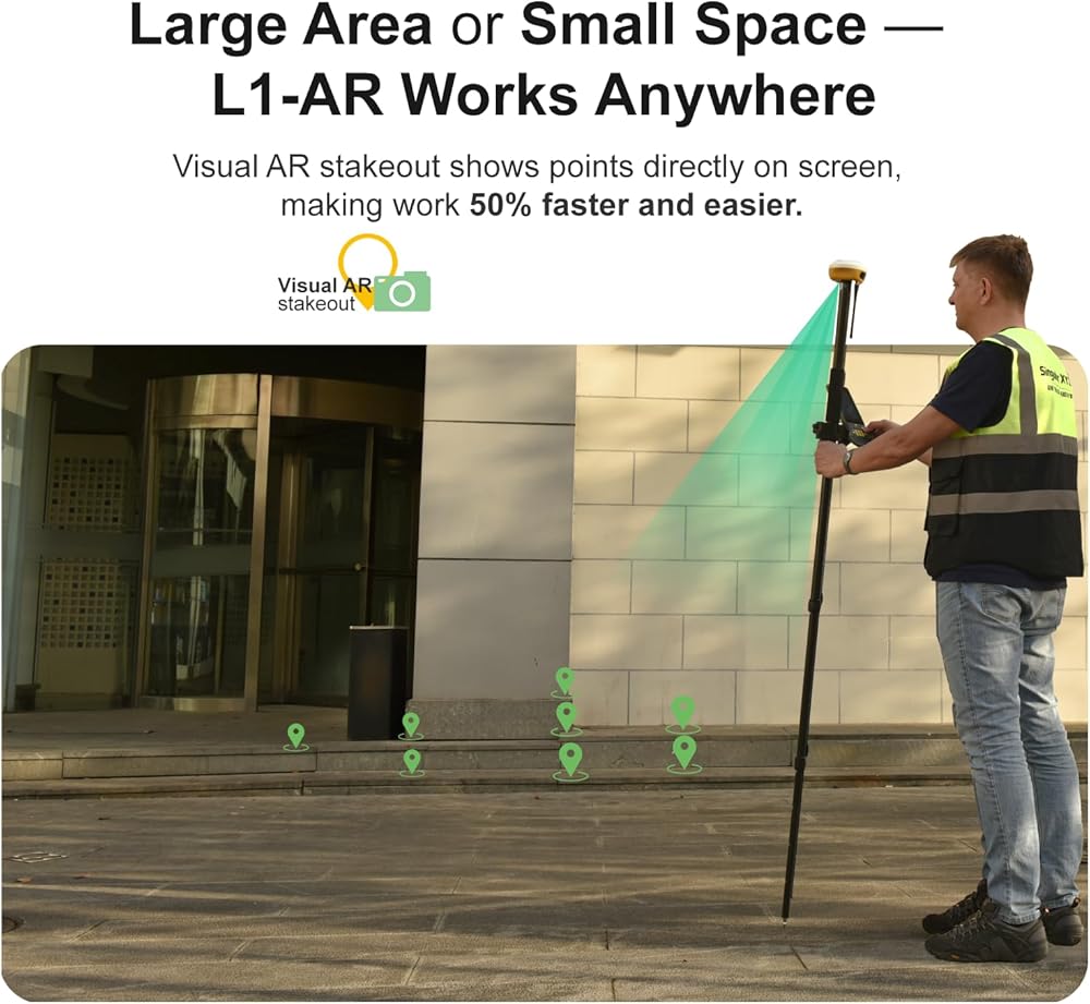
【AR Stakeout】L1-AR rtk gps enables AR stakeout—overlaying virtual point guidance on the camera view for faster, intuitive field layout, and the handheld collector also can enables AR stakeout.
【Global shutter with 2 MP】L1-AR rtk features a 2MP starlight camera with 75° FOV for visual AR stakeoutCentimeter-level accuracy, reliable even in low-light conditions.Full-constellation tracking ensures fast FlX in complex environments.
【Simplify Your Workflow with CAD】L1 AR rtk gnss integrates CAD drawings with real-world scenes, letting youstakeout targets faster.The bottom camera ensures precise positioning as you approach.Making stakeout easier and more intuitive. Sapport DWG,DXF CAD.
【120° Tilt Compensation】High-grade IMU supports ±60° tilt with auto-calibration, achieving 2cm accuracy at maximum tilt for faster, pole-free topographic surveys.
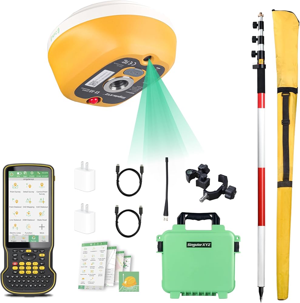
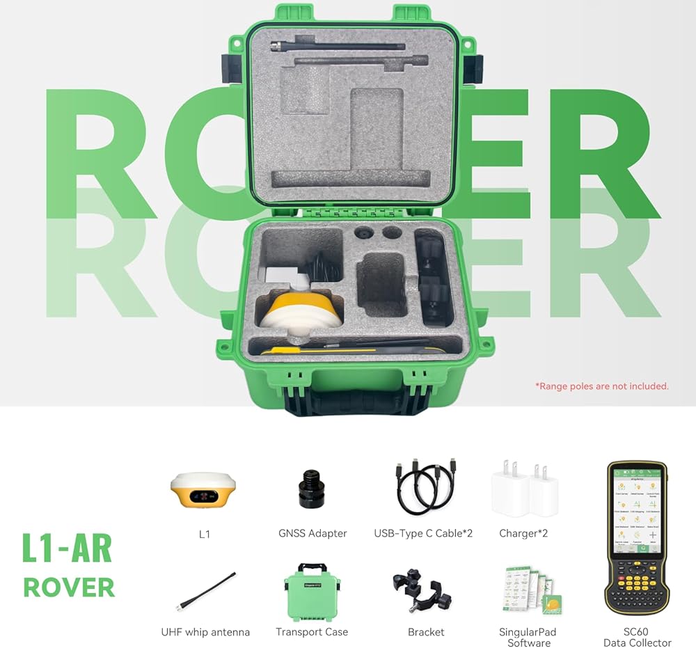
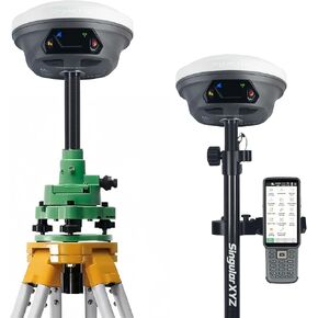
 RTK GNSS Survey Equipment with Network RTK Rover, Handheld Controller and Survey Software, Featuring a 60° Tilt and Built-in IMU, for Construction and Geodetic or Land Survey Layout Planning
SAR 6,746
RTK GNSS Survey Equipment with Network RTK Rover, Handheld Controller and Survey Software, Featuring a 60° Tilt and Built-in IMU, for Construction and Geodetic or Land Survey Layout Planning
SAR 6,746
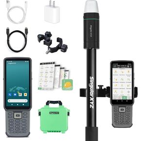
 E1 RTK GNSS Survey Equipment 20 Hours Endurance RTK GNSS GPS with IMU Rover & Base Handheld Collector with Survey Software RTK Surveying Equipment,1408 Channels, 5km UHF Range,60° Tilt Survey
SAR 11,872
E1 RTK GNSS Survey Equipment 20 Hours Endurance RTK GNSS GPS with IMU Rover & Base Handheld Collector with Survey Software RTK Surveying Equipment,1408 Channels, 5km UHF Range,60° Tilt Survey
SAR 11,872
 E1 GNSS IMU RTK GPS Surveying Equipment Rover Receiver Rtk Gnss Handheld Collector and Survey Software, 1408 Channels, 1cm Accuracy, 5km Distance
SAR 7,434
E1 GNSS IMU RTK GPS Surveying Equipment Rover Receiver Rtk Gnss Handheld Collector and Survey Software, 1408 Channels, 1cm Accuracy, 5km Distance
SAR 7,434
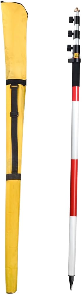
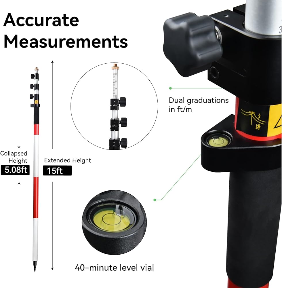
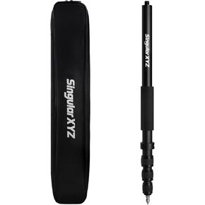 Carbon Fiber GPS Rover Rod Telescopic GPS Rover Rod for Land Surveying & Engineering – RTK GPS/GNSS Accessory for Surveying and Measuring Poles
SAR 548
Carbon Fiber GPS Rover Rod Telescopic GPS Rover Rod for Land Surveying & Engineering – RTK GPS/GNSS Accessory for Surveying and Measuring Poles
SAR 548