- Shopping, made easy.
- /
- Get the app!
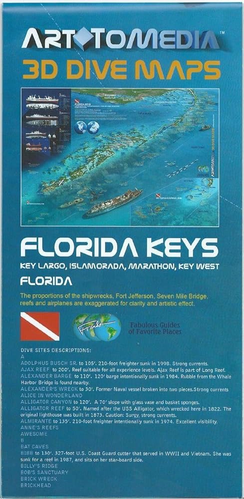
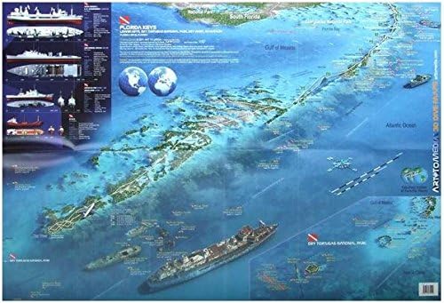
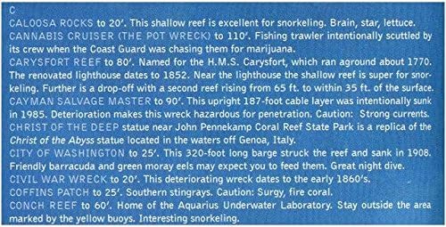
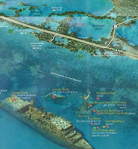
Florida Keys 3D Dive & Wreck Maps by ArtToMedia - Waterproof, Rip-Resistant Map. Double sided dive map covers the Florida Keys area from Key Largo to Dry Tortugas National Park at scale approx. 1:140,000. Numerous sites of shipwrecks are indicated, most with lat/lon coordinates. Major wrecks are presented by 3D pictures. Selected wrecks are portrayed by precise drawings and technical specification. Also, an extensive list of dive sites with descriptions. Printed on synthetic paper, this map is waterproof so it can be used underwater. Look at our images to truly understand this product! 26" x 18" folded to 4" x 9", printed on waterproof synthetic material.
 GATHRE World Map Poster (20 x 30 inches) Wipeable & Waterproof Educational Tapestry for Kids | Ready-to-hang Decor in Office, Toddler's Room or Nursery | Made of Wear-Resistant Leather Material
SAR 365
GATHRE World Map Poster (20 x 30 inches) Wipeable & Waterproof Educational Tapestry for Kids | Ready-to-hang Decor in Office, Toddler's Room or Nursery | Made of Wear-Resistant Leather Material
SAR 365
 205 Pcs Reward Punch Cards Behavior Incentive Awards for Kids Students Behavior Teachers Home Classroom Homework Assignments Attendance Positive Behavior Chores (Wild Animals)
SAR 32
205 Pcs Reward Punch Cards Behavior Incentive Awards for Kids Students Behavior Teachers Home Classroom Homework Assignments Attendance Positive Behavior Chores (Wild Animals)
SAR 32
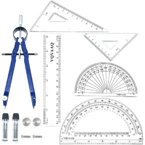 6 Piece Geometry School Set, 6 in 1 Tool with Compass, Linear Ruler, Set Squares, Protractor, Triangle Ruler (6 pcs-Blue)
SAR 42
6 Piece Geometry School Set, 6 in 1 Tool with Compass, Linear Ruler, Set Squares, Protractor, Triangle Ruler (6 pcs-Blue)
SAR 42
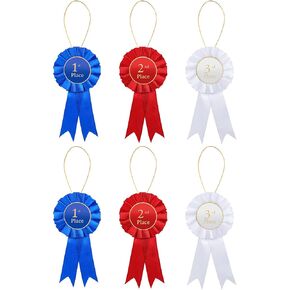 6 Pcs Satin Participation Ribbon Award Ribbon Rosette Set 1st 2nd 3rd Place Rosette Ribbons Blue Red and White Prize Ribbons Badge Ribbons Honorable Medal Ribbons for Classroom Prize Talent Show
SAR 36
6 Pcs Satin Participation Ribbon Award Ribbon Rosette Set 1st 2nd 3rd Place Rosette Ribbons Blue Red and White Prize Ribbons Badge Ribbons Honorable Medal Ribbons for Classroom Prize Talent Show
SAR 36