- Shopping, made easy.
- /
- Get the app!
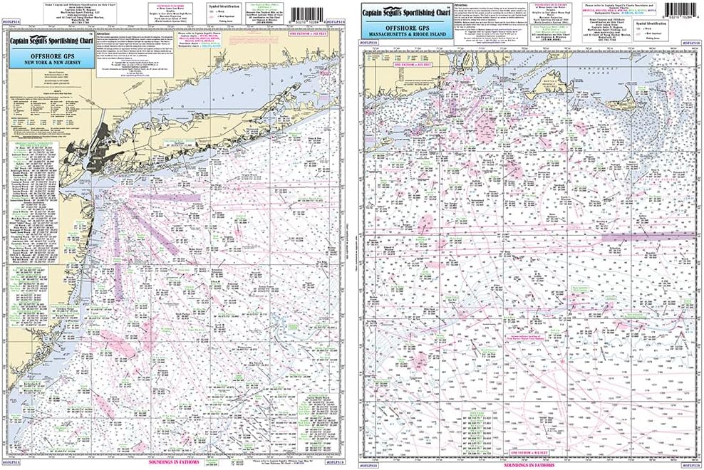
Offshore Fishing Chart: Offshore canyon chart from side A, Nantucket Shoals to tip of Montauk, NY south to cover all canyons beginning with the Veatch Canyon. Side B extends from Montauk to Five Fathom Bank off Cape May, NJ, ending in the west with Lindenkohl Canyon, includes a detailed inset of the Ambrose Channel going into New York shows hundreds of local fishing locations with local names and GPS coordinates. 19.5" x 26.5"
 Calissa Offshore Tackle Marine VHF Antenna Mount – Adjustable Base Mounts Ratchet Boat for Boats – Made with 316 Stainless Steel Mounts
SAR 206
Calissa Offshore Tackle Marine VHF Antenna Mount – Adjustable Base Mounts Ratchet Boat for Boats – Made with 316 Stainless Steel Mounts
SAR 206
 -3%
HUK Pursuit Volley Pattern, Quick-Dry Shorts for Women
SAR 177
-3%
HUK Pursuit Volley Pattern, Quick-Dry Shorts for Women
SAR 177
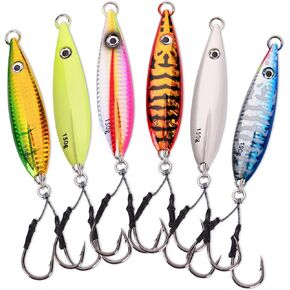 Calissa Offshore Tackle Fast Fall Jig 80g 150g 250g 300LBS Assist Hooks 3/0 Butterfly - Vertical Speed Lure Slow Pitch Flat - Glow Color Painted on Both Sides
SAR 261
Calissa Offshore Tackle Fast Fall Jig 80g 150g 250g 300LBS Assist Hooks 3/0 Butterfly - Vertical Speed Lure Slow Pitch Flat - Glow Color Painted on Both Sides
SAR 261
 -6%
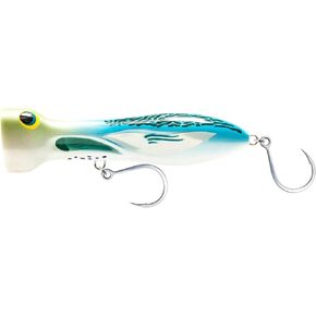
Nomad Design Chug Norris Topwater Popper Lure Collection – Floating Offshore Saltwater Surface Fishing Plug - Durable HD Body for Big Game - Realistic Splash & Erratic Action
SAR 84
-6%
Nomad Design Chug Norris Topwater Popper Lure Collection – Floating Offshore Saltwater Surface Fishing Plug - Durable HD Body for Big Game - Realistic Splash & Erratic Action
SAR 84