- التسوق ، اصبح سهلا.
- /
- احصل على التطبيق!
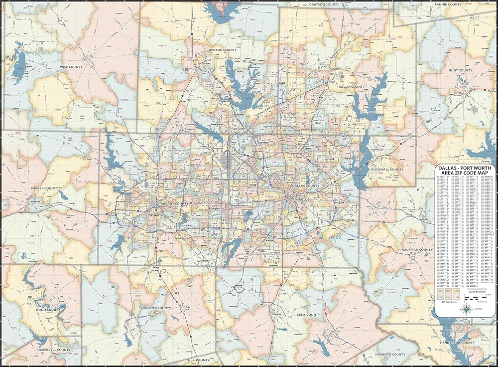
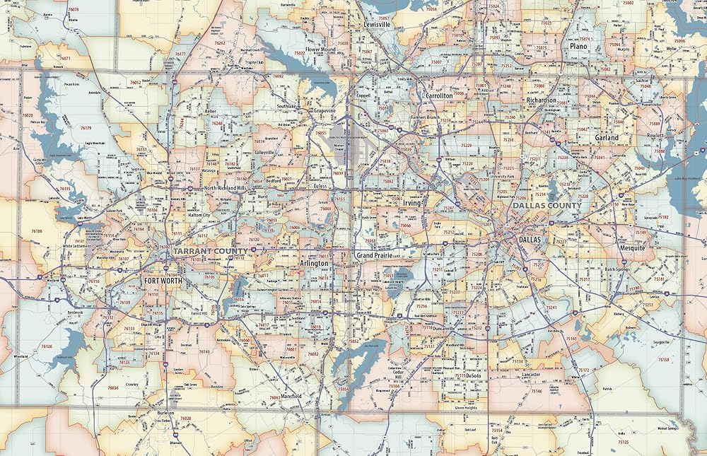
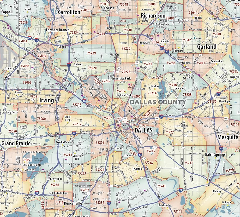
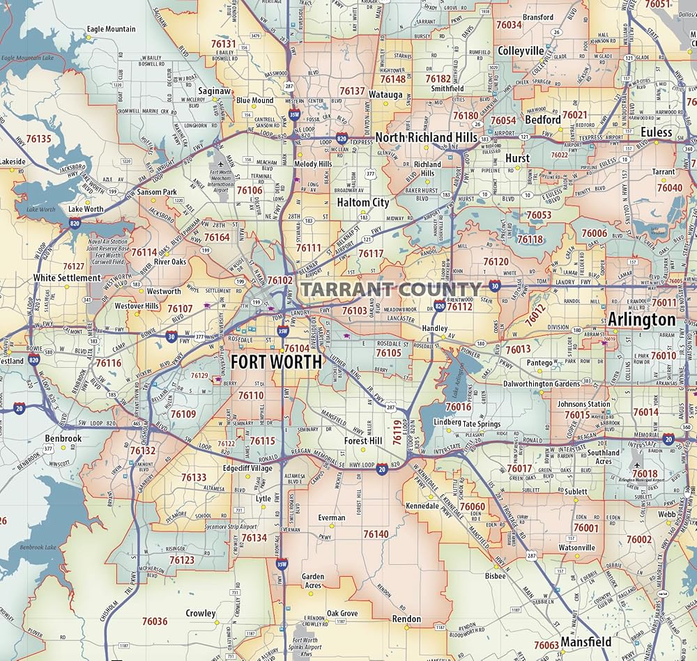
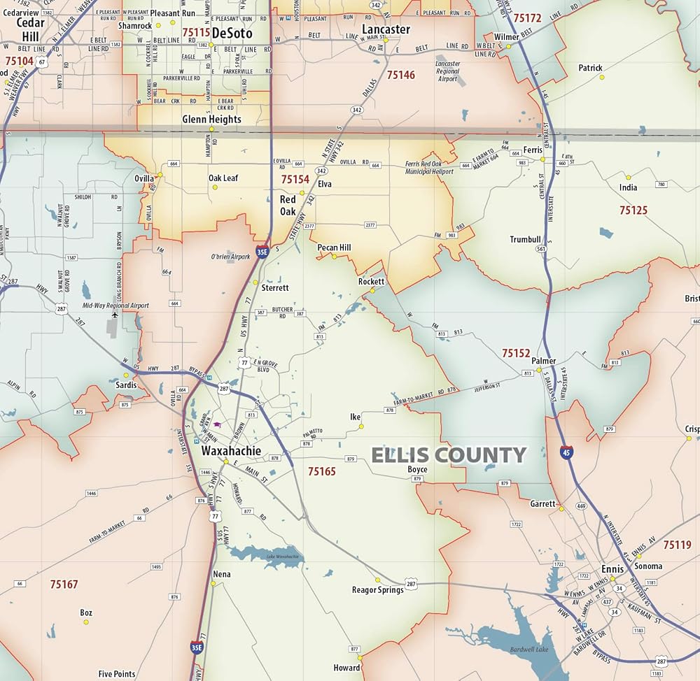
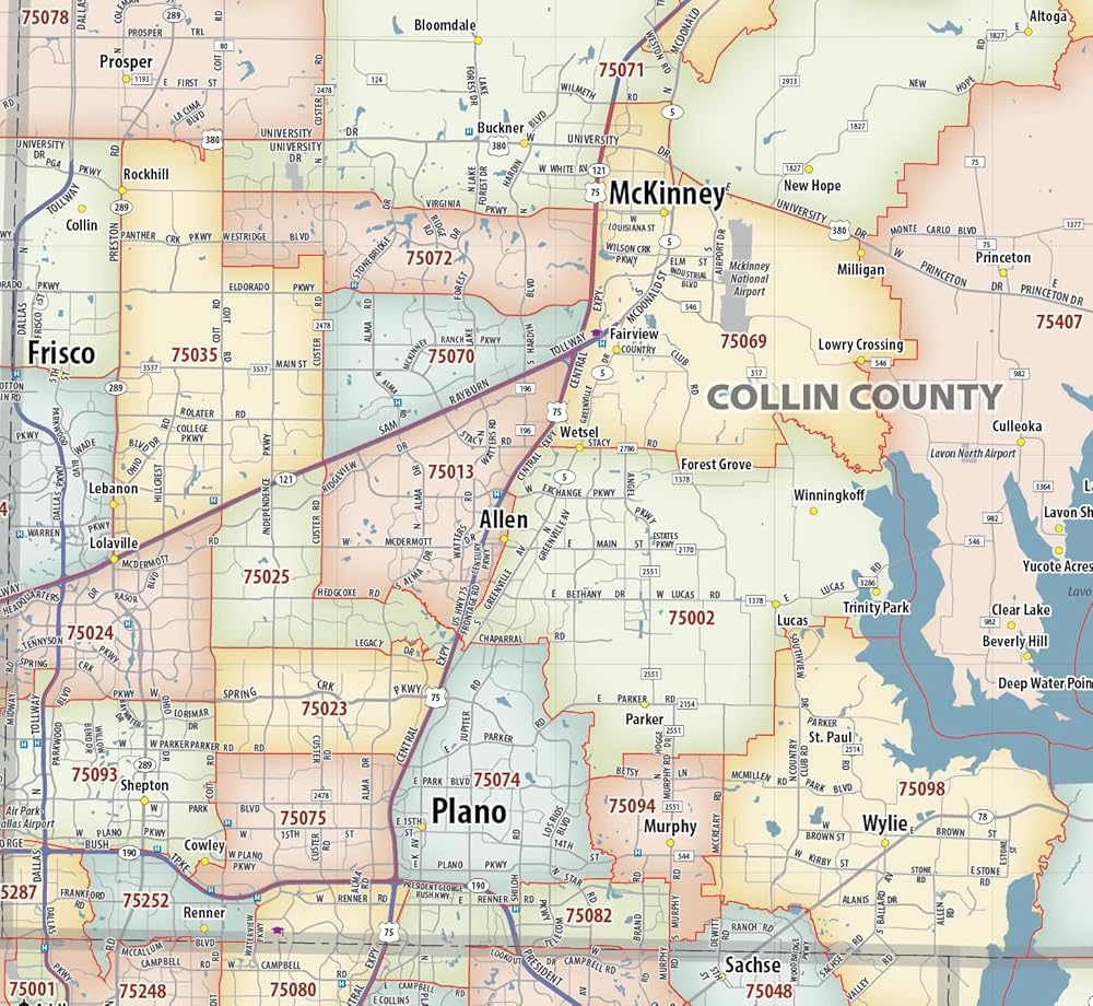
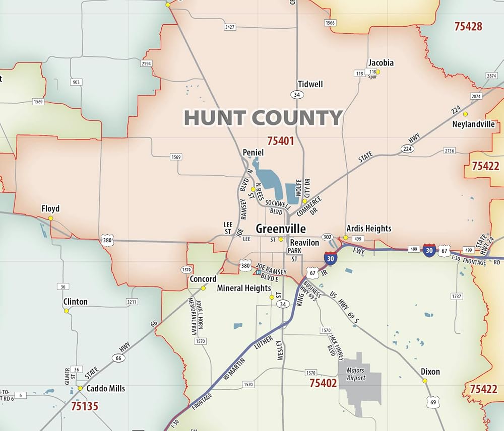
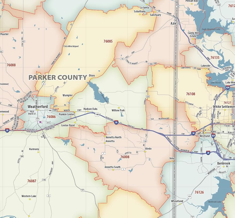
Our laminated Dallas - Fort Worth Metro Area ZIP Code Map highlights zip code areas in a 110 mile wide by 80 mile high region surrounding the DFW area. The perfect tool for visualizing the big picture of the Dallas - Fort Worth Metro Area, each zip code is colorized and labeled for quick identification. The map also shows counties, communities, and major roads. An index of zip codes is included for easy reference. The map is printed on heavyweight paper with a dry-erase lamination that allows the use of write-on/wipe-off dry-erase markers. It is rolled and shipped in a sturdy tube.
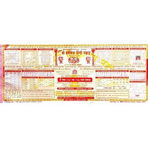 كتاب Panchang Hindu Book Hindi Panchang Book باللغة الهندية المقدسة الكتاب الهندوسي حزمة الكتب الدينية من 1
SAR 157
كتاب Panchang Hindu Book Hindi Panchang Book باللغة الهندية المقدسة الكتاب الهندوسي حزمة الكتب الدينية من 1
SAR 157
 الكتب السحرية الإسبانية تعلم الحروف في تتبع المصنف للأطفال دفاتر القابلة لإعادة الاستخدام للأطفال الإسبانية مونتيسوري الكتابة (4 كتب)
SAR 97
الكتب السحرية الإسبانية تعلم الحروف في تتبع المصنف للأطفال دفاتر القابلة لإعادة الاستخدام للأطفال الإسبانية مونتيسوري الكتابة (4 كتب)
SAR 97
 مجموعة مجموعة الكتب الـ 6 الكتب من سلسلة Diaries (Night Novel) (الكتب من 1 إلى 6)-لغز تاريخي ومؤامرات للمحكمة في الإمبراطورية القديمة المستوحاة من الصين
SAR 512
مجموعة مجموعة الكتب الـ 6 الكتب من سلسلة Diaries (Night Novel) (الكتب من 1 إلى 6)-لغز تاريخي ومؤامرات للمحكمة في الإمبراطورية القديمة المستوحاة من الصين
SAR 512
 -7%
anydesign Boho Round Clutouts مع 100pcs Glue Points 16 ألوان دائرة القطع الورقية الملونة جولة القطع ديكور لوحات لوحة للعودة إلى المدرسة DIY الحرف الحديثة الحزب لصالح ، 80pcs
SAR 63
-7%
anydesign Boho Round Clutouts مع 100pcs Glue Points 16 ألوان دائرة القطع الورقية الملونة جولة القطع ديكور لوحات لوحة للعودة إلى المدرسة DIY الحرف الحديثة الحزب لصالح ، 80pcs
SAR 63