- Shopping, made easy.
- /
- Get the app!
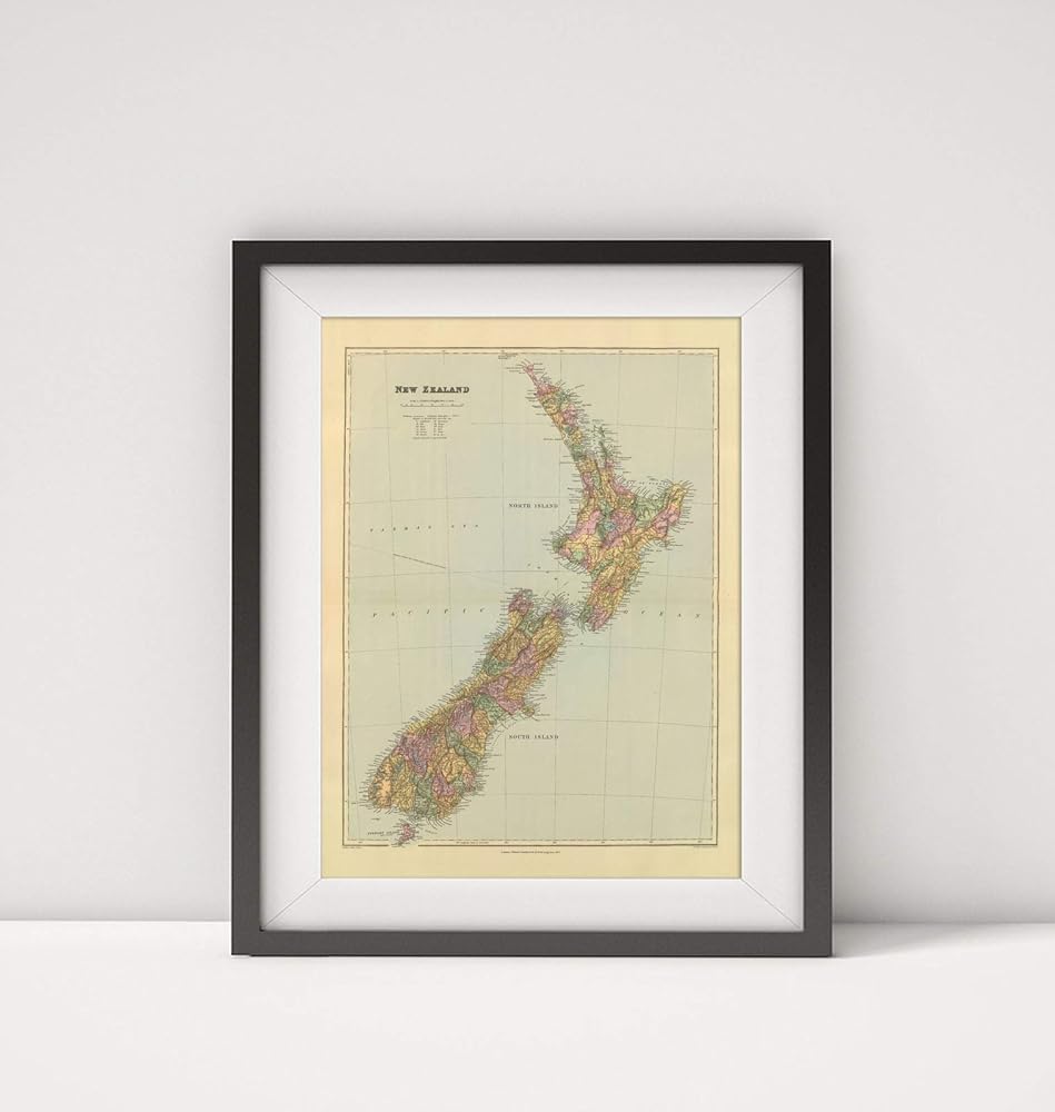
World Atlas: New Zealand. London atlas series. Stanford's Geographical Estabt. London : Edward Stanford, 12, 13 & 14, Long Acre, W.C. (1901) | Stanford's London atlas of universal geography exhibiting the physical and political divisions of the various countries of the world. Folio edition. One hundred maps, with a list of latitudes and longitudes. Second issue, revised and enlarged. London, Edward Stanford, Geographer to Her Majesty, 12, 13 & 14 Long Acre, W.C. 1901. Counties in full color. Relief shown by shading and spot heights. Shows settlements, railroads, submarine telegraph cables, etc.
 TEACHER CREATED RESOURCES Context Clues Practice Cards
SAR 79
TEACHER CREATED RESOURCES Context Clues Practice Cards
SAR 79
 100 Pcs Autism Awareness Slap Bracelets Colorful Puzzle Pieces Autism Bracelet Wristbands Autism Bracelet Bulk for Adults Autism Awareness Party Favor Decorations Gift Supplies
SAR 63
100 Pcs Autism Awareness Slap Bracelets Colorful Puzzle Pieces Autism Bracelet Wristbands Autism Bracelet Bulk for Adults Autism Awareness Party Favor Decorations Gift Supplies
SAR 63
 Yearly Educational Course Books for 1-2 Year Olds - "Первые знания" Series in Russian (Обучающие книги), 6-Book Set for Early Learning
SAR 105
Yearly Educational Course Books for 1-2 Year Olds - "Первые знания" Series in Russian (Обучающие книги), 6-Book Set for Early Learning
SAR 105
 Hespama 18.5 Inch Square Plastic Stool Chair, White Classroom Stools Set of 12, Backless High Stools
SAR 611
Hespama 18.5 Inch Square Plastic Stool Chair, White Classroom Stools Set of 12, Backless High Stools
SAR 611