- Shopping, made easy.
- /
- Get the app!
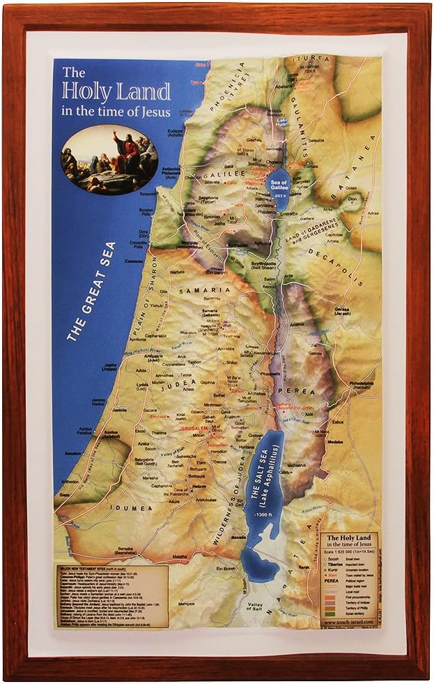
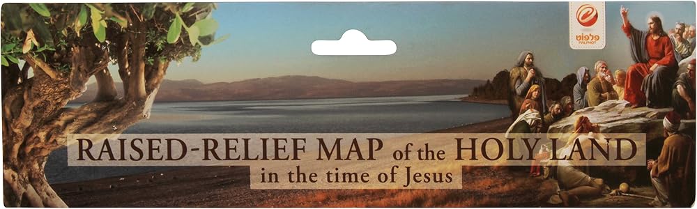
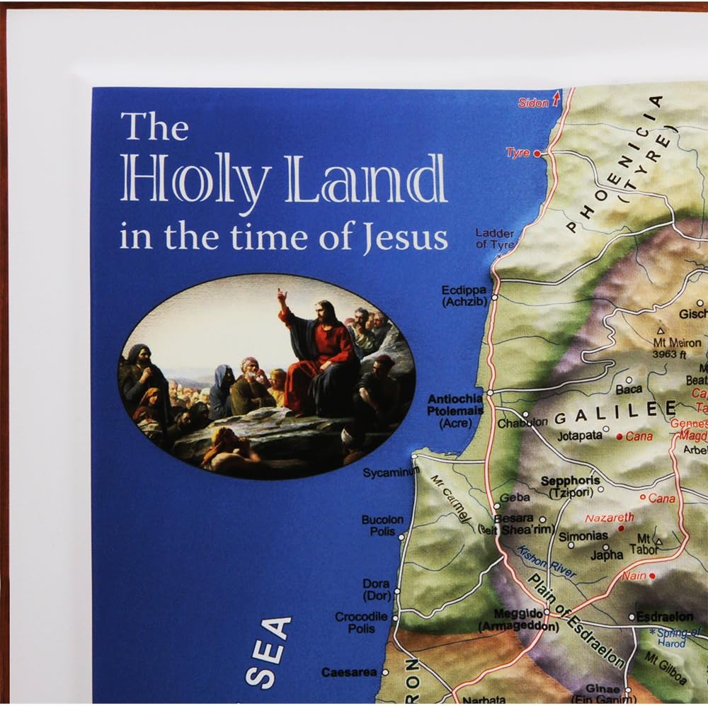
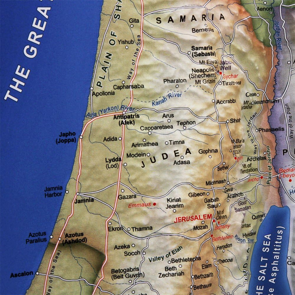
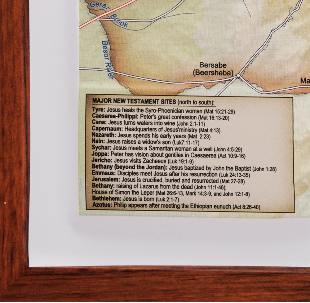
Introducing our meticulously crafted 3D Raised Relief Map of Israel during the time of Jesus, a must-have piece for history enthusiasts, educators, and travelers alike!
This striking, high-quality map brings the Holy Land to life, illustrating the landscape and culture of the region during the Roman Empire in vivid detail.
Measuring 14" x 9.5" (36 cm x 23 cm), the map showcases Roman place names, surrounding territories, and significant landmarks, all presented in full color.
With its intricate 3D topography, you'll feel the elevation of the hills and valleys, gaining a deeper appreciation for the terrain that shaped the history of this ancient land.
The map also highlights key locations such as Jerusalem, Bethlehem, Nazareth, and the Sea of Galilee, enabling you to follow the footsteps of Jesus and other prominent figures of the time. In the office, Home, or classroom, inviting conversation and reflection on the rich history of Israel and the Holyland and its significance to millions of people around the world
Order yours today and embark on an unforgettable journey through time!
 USA Scratch Off Map by Vespigo - 24x17 - National Parks - State Flags - Scenic Trails - Bonus Accessories Pack with Unique Discover America brochure
SAR 115
USA Scratch Off Map by Vespigo - 24x17 - National Parks - State Flags - Scenic Trails - Bonus Accessories Pack with Unique Discover America brochure
SAR 115
 Gold Star Stickers,1800 pcs 40 Sheet 0.5 Inch Small Foil Star Sticker for Kids Reward School Planner Behavior Chart,Reward Stickers for Children Classroom Teacher Supplies(Yellow, 40)
SAR 26
Gold Star Stickers,1800 pcs 40 Sheet 0.5 Inch Small Foil Star Sticker for Kids Reward School Planner Behavior Chart,Reward Stickers for Children Classroom Teacher Supplies(Yellow, 40)
SAR 26
 Weekly Visual Schedule for Kids,Weekly Calendar for Toddler Planner Kids Routine Chart Includes 259 Cards for Home School - Daily, Weekly, Monthly, Yearly Routine Chart for Kids, Teenagers, Adults
SAR 84
Weekly Visual Schedule for Kids,Weekly Calendar for Toddler Planner Kids Routine Chart Includes 259 Cards for Home School - Daily, Weekly, Monthly, Yearly Routine Chart for Kids, Teenagers, Adults
SAR 84
 2-Decal Set Autism Awareness Rainbow Infinity Symbol
SAR 42
2-Decal Set Autism Awareness Rainbow Infinity Symbol
SAR 42