- Shopping, made easy.
- /
- Get the app!
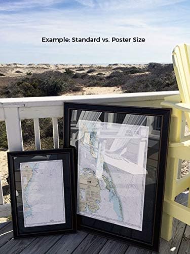
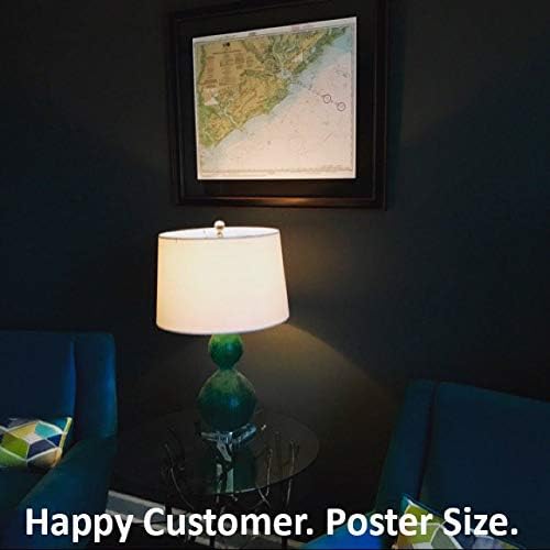
Point Judith Harbor, RI NOAA 13219. This Framed Nautical Map covers the waters and coast line of Point Judith Harbor, Rhode Island. The Framed Nautical Chart is the official NOAA Nautical Chart detailing the waters of the beautiful Point Judith Harbor; including Point Judith Neck, Snug Harbor, Potter Pond, and Point Judith Pond. NOAA Nautical Chart 13219. Standard frame is approx 18" H x 24" W. Poster frame is approx 28" H x 36" W. Solid Hardwood Frame, Glass Front, Black Mat, Paper Duster Backing with Wire Hanging, Handmade in USA
 Babo Botanicals Sensitive Baby Fragrance-Free 2-in-1 Shampoo & Wash - with Shea Butter, Calendula & Aloe Vera - EWG Verified, Cruelty-Free & Vegan - Pediatrician Tested - 8 fl. oz.
SAR 76
Babo Botanicals Sensitive Baby Fragrance-Free 2-in-1 Shampoo & Wash - with Shea Butter, Calendula & Aloe Vera - EWG Verified, Cruelty-Free & Vegan - Pediatrician Tested - 8 fl. oz.
SAR 76
 Rock-N-Rescue Utility and Ladder Belt - Firefighting and Rescue Gear, Adjustable
SAR 522
Rock-N-Rescue Utility and Ladder Belt - Firefighting and Rescue Gear, Adjustable
SAR 522
 Merry Christmas! Level 4 (Alfred's Basic Piano Library)
SAR 47
Merry Christmas! Level 4 (Alfred's Basic Piano Library)
SAR 47
 -19%
Christmas Carol Activity Book: Pre-reading (10 Christmas Favorites with Corresponding Musical Activity Pages for the Beginning Pianist)
SAR 43
-19%
Christmas Carol Activity Book: Pre-reading (10 Christmas Favorites with Corresponding Musical Activity Pages for the Beginning Pianist)
SAR 43