- Shopping, made easy.
- /
- Get the app!
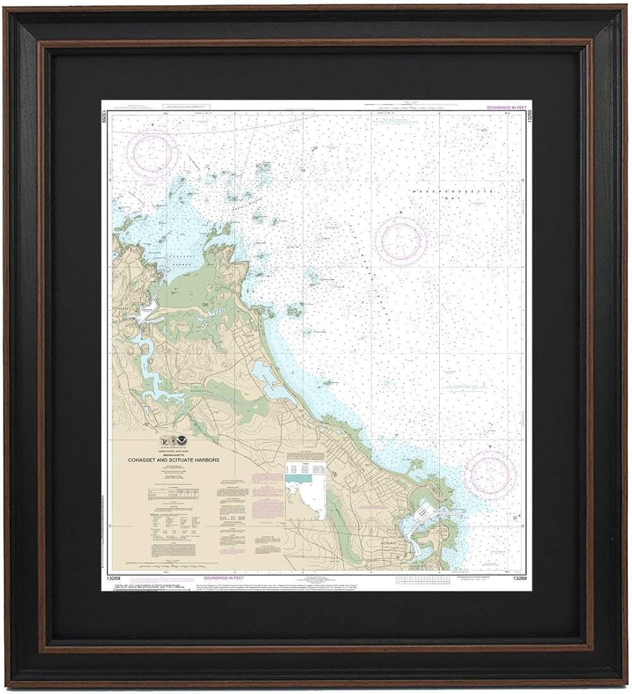
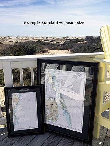
Cohasset and Scituate Harbors, MA NOAA 13269. This Framed Nautical Map covers the waters of Cohasset and Scituate Harbors, MA. The Framed Nautical Chart is the official NOAA Nautical Chart detailing the beautiful waters and coastline of Cohasset and Scituate Harbors; including Massachusetts Bay, and other towns and harbors. NOAA Nautical Chart 13269. Standard frame is approx 20" W x 24" H. Poster frame is approx 30" W x 36" H. Solid Hardwood Frame, Glass Front, Black Mat, Paper Duster Backing with Wire Hanging, Handmade in USA.
 -41%
Rise Up Singing : The Group Singing Songbook: (larger print leader's edition)
SAR 124
-41%
Rise Up Singing : The Group Singing Songbook: (larger print leader's edition)
SAR 124
 -8%
Whimsical Cross-Stitch: More Than 130 Designs from Trendy to Traditional (Dover Crafts: Embroidery & Needlepoint)
SAR 97
-8%
Whimsical Cross-Stitch: More Than 130 Designs from Trendy to Traditional (Dover Crafts: Embroidery & Needlepoint)
SAR 97
 -18%
Chain Maille Jewelry Workshop: Techniques and Projects for Weaving with Wire
SAR 111
-18%
Chain Maille Jewelry Workshop: Techniques and Projects for Weaving with Wire
SAR 111
 -57%
Stunning Digital Photography
SAR 56
-57%
Stunning Digital Photography
SAR 56