- Shopping, made easy.
- /
- Get the app!
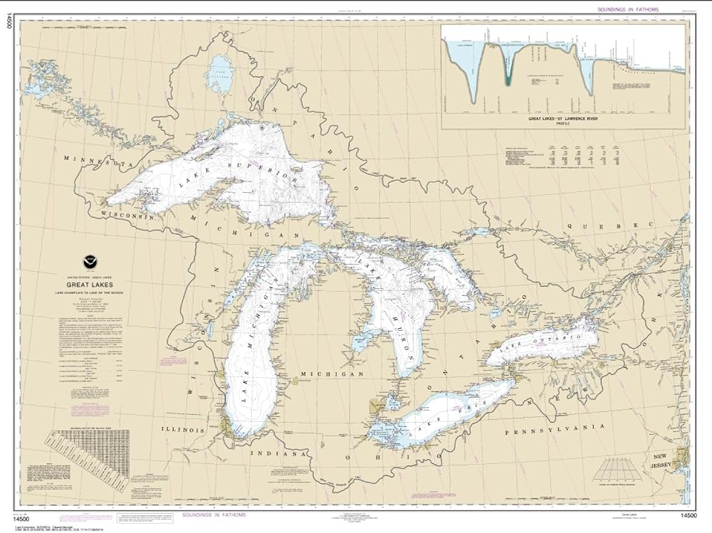
East View Geospatial (EVG), a certified NOAA and NGA print on demand printer; provides mariners with up-to-date National Oceanic and Atmospheric Administration (NOAA) approved nautical charts. Our Great Lakes nautical chart (Map Index 14500) is printed using high resolution, heavy weight and acid free paper. All charts are printed with the latest Notice to Mariners (NTMs), and meet United States Coast Guard and international carriage requirements for commercial and recreational vessels. All NOAA nautical charts ship rolled, and are printed by East View Geospatial.
 -15%
Garmin GMS 10 Network Port Expander + Garmin 010-11425-10 Network Cable 20' Bundle
SAR 1,103
-15%
Garmin GMS 10 Network Port Expander + Garmin 010-11425-10 Network Cable 20' Bundle
SAR 1,103
 -23%
Humminbird 601003-1 LakeMaster - Great Plains V1
SAR 604
-23%
Humminbird 601003-1 LakeMaster - Great Plains V1
SAR 604
 Rockford Fosgate M1-6B Color Optix 6" 2-Way Coaxial Multicolor LED Lighted Marine Speakers - Black (Pair)
SAR 1,059
Rockford Fosgate M1-6B Color Optix 6" 2-Way Coaxial Multicolor LED Lighted Marine Speakers - Black (Pair)
SAR 1,059
 Atibin Portable Kayak Depth Finder Fishing Wireless Castable Fishing Finder Transducer Canoe Shore Fish Finder Detector Sonar Handheld Sea Lake
SAR 329
Atibin Portable Kayak Depth Finder Fishing Wireless Castable Fishing Finder Transducer Canoe Shore Fish Finder Detector Sonar Handheld Sea Lake
SAR 329