- Shopping, made easy.
- /
- Get the app!
Unique, full color, and detailed this political map of "United Kingdom and Ireland" features geographic detail and accuracy. The map shows all UK state country boundaries, place names, a selection National Parks, Airports, bodies of water, and more. Inset maps show the Shetland & Orkney Islands. Perfect for Schools, Home, Office or Home Schooling.
 Tennessee State Wall Map Large Print Poster- Poster Size (36"Wx18"H) Rolled (Laminated)
SAR 131
Tennessee State Wall Map Large Print Poster- Poster Size (36"Wx18"H) Rolled (Laminated)
SAR 131
 Cool Owl Maps Iowa State Wall Map Poster Rolled 34"Wx24"H (laminated)
SAR 131
Cool Owl Maps Iowa State Wall Map Poster Rolled 34"Wx24"H (laminated)
SAR 131
 CoolOwlMaps North America Continent Wall Map Poster - Rolled (Laminated 24x32)
SAR 110
CoolOwlMaps North America Continent Wall Map Poster - Rolled (Laminated 24x32)
SAR 110
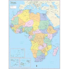 Cool Owl Maps Africa Continent Wall Map Poster - Rolled Laminated (24"x32")
SAR 131
Cool Owl Maps Africa Continent Wall Map Poster - Rolled Laminated (24"x32")
SAR 131

