- Shopping, made easy.
- /
- Get the app!
 The Histomap: Four Thousand Years of World History, Relative Power of Contemporary States, Nations and Empires Timeline circa 1931 | 4,000 Year Chart Poster Classroom Decor | Ancient Civilizations Wall Map | Homeschool School Social Studies Teacher Gift
SAR 157
The Histomap: Four Thousand Years of World History, Relative Power of Contemporary States, Nations and Empires Timeline circa 1931 | 4,000 Year Chart Poster Classroom Decor | Ancient Civilizations Wall Map | Homeschool School Social Studies Teacher Gift
SAR 157
 Historic Map | Pebble Beach Links Golf Course | Del Monte Lodge California | Vintage Championship Layout circa 1956 | Professional Golf Art Print (24 x 42 inches)
SAR 141
Historic Map | Pebble Beach Links Golf Course | Del Monte Lodge California | Vintage Championship Layout circa 1956 | Professional Golf Art Print (24 x 42 inches)
SAR 141
 Antiguos Maps Pictorial Alaska, the 49th State by Alaska News Agency circa 1959 | Vintage Wall Decor | Art Print Poster
SAR 115
Antiguos Maps Pictorial Alaska, the 49th State by Alaska News Agency circa 1959 | Vintage Wall Decor | Art Print Poster
SAR 115
 Antiguos Maps USA Plant Hardiness Zones | Includes Hawaii, Alsaka and Puerto Rico | Art Print Poster
SAR 141
Antiguos Maps USA Plant Hardiness Zones | Includes Hawaii, Alsaka and Puerto Rico | Art Print Poster
SAR 141
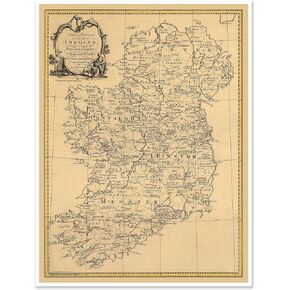 Antiguos Maps Historic Map of Ireland Illustrated with Irish Names, Surnames, Boundaries of Provinces and Counties | Art Print Poster Vintage Wall Decor | 18 x 24 inches
SAR 115
Antiguos Maps Historic Map of Ireland Illustrated with Irish Names, Surnames, Boundaries of Provinces and Counties | Art Print Poster Vintage Wall Decor | 18 x 24 inches
SAR 115
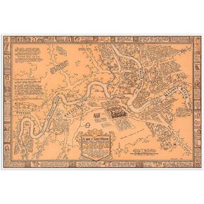
 Antiguos Maps Plan of the City of Washington DC and Georgetown circa 1867 | Art Print Poster Vintage Wall Decor | 18 x 24 inches (457 x 610 mm)
SAR 115
Antiguos Maps Plan of the City of Washington DC and Georgetown circa 1867 | Art Print Poster Vintage Wall Decor | 18 x 24 inches (457 x 610 mm)
SAR 115
 Antiguos Maps Large Pictorial of Fort Wayne Indiana in 1812 circa 1930 | Art Print Poster Vintage Wall Decor | 24 x 36 inches (610 x 915 mm)
SAR 141
Antiguos Maps Large Pictorial of Fort Wayne Indiana in 1812 circa 1930 | Art Print Poster Vintage Wall Decor | 24 x 36 inches (610 x 915 mm)
SAR 141
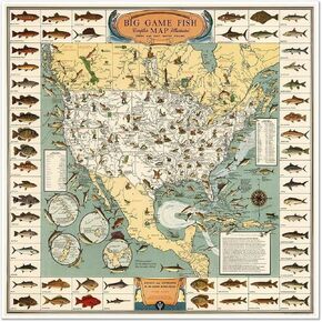 Vintage Big Game Fish Map of North America, Illustrated Fresh and Salt Water Fishing Guide, Decorative Wall Art Print (24 x 24 inches)
SAR 94
Vintage Big Game Fish Map of North America, Illustrated Fresh and Salt Water Fishing Guide, Decorative Wall Art Print (24 x 24 inches)
SAR 94
 Antiguos Maps Northern Ireland circa 1947 | Art Print Poster Vintage Wall Decor | 24 x 32 inches (610 x 813 mm)
SAR 141
Antiguos Maps Northern Ireland circa 1947 | Art Print Poster Vintage Wall Decor | 24 x 32 inches (610 x 813 mm)
SAR 141
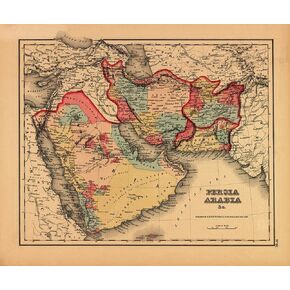 Antiguos Maps Middle East Including Persia and Arabia circa 1855 by J.H. Colton | Art Print Poster Vintage Wall Decor | 18 x 24 inches (457 x 610 mm)
SAR 115
Antiguos Maps Middle East Including Persia and Arabia circa 1855 by J.H. Colton | Art Print Poster Vintage Wall Decor | 18 x 24 inches (457 x 610 mm)
SAR 115
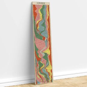
 The Histomap: Four Thousand Years of World History, Relative Power of Contemporary States, Nations and Empires Timeline circa 1931 | 4,000 Year Chart Poster Classroom Decor | Ancient Civilizations Wall Map | Homeschool School Social Studies Teacher Gift (
SAR 157
The Histomap: Four Thousand Years of World History, Relative Power of Contemporary States, Nations and Empires Timeline circa 1931 | 4,000 Year Chart Poster Classroom Decor | Ancient Civilizations Wall Map | Homeschool School Social Studies Teacher Gift (
SAR 157
 The Histomap: Four Thousand Years of World History, Relative Power of Contemporary States, Nations and Empires Timeline circa 1931 | 4,000 Year Chart Poster Classroom Decor | Ancient Civilizations Wall Map | Homeschool School Social Studies Teacher Gift (
SAR 131
The Histomap: Four Thousand Years of World History, Relative Power of Contemporary States, Nations and Empires Timeline circa 1931 | 4,000 Year Chart Poster Classroom Decor | Ancient Civilizations Wall Map | Homeschool School Social Studies Teacher Gift (
SAR 131
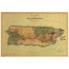 Antiguos Maps Topografico de la Isla de Puerto Rico circa 1886 | Vintage Wall Decor | Art Print Poster | measures 24 x 36 inches (610 x 915 mm)
SAR 141
Antiguos Maps Topografico de la Isla de Puerto Rico circa 1886 | Vintage Wall Decor | Art Print Poster | measures 24 x 36 inches (610 x 915 mm)
SAR 141
 Antiguos Maps Baja Lower California circa 1955 | Art Print Poster Vintage Wall Decor | 12 x 30 inches
SAR 141
Antiguos Maps Baja Lower California circa 1955 | Art Print Poster Vintage Wall Decor | 12 x 30 inches
SAR 141
 Antiguos Maps Elegant Scotland circa 1822 | Art Print Poster Vintage Wall Decor | 18 x 24 inches (457 x 610 mm)
SAR 115
Antiguos Maps Elegant Scotland circa 1822 | Art Print Poster Vintage Wall Decor | 18 x 24 inches (457 x 610 mm)
SAR 115
 Florida State Map by Charles Vignoles circa 1823 Historical Sepia Tone Gulf Coast Navigation Chart | Art Print Poster Vintage Wall Decor (24 x 32 inches)
SAR 94
Florida State Map by Charles Vignoles circa 1823 Historical Sepia Tone Gulf Coast Navigation Chart | Art Print Poster Vintage Wall Decor (24 x 32 inches)
SAR 94
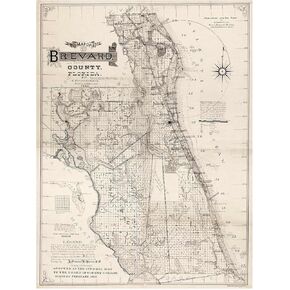 Antiguos Maps Brevard County Florida by J. Francis Le Baron circa 1893 | Art Print Poster Vintage Wall Decor | 24 x 32 inches (610 x 813 mm)
SAR 141
Antiguos Maps Brevard County Florida by J. Francis Le Baron circa 1893 | Art Print Poster Vintage Wall Decor | 24 x 32 inches (610 x 813 mm)
SAR 141
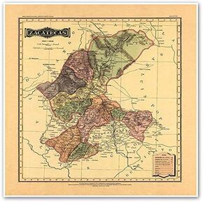 Antiguos Maps Estado Libre y Soberano de Zacatecas from Atlas Mexicano circa 1884 | Art Print Poster Vintage Wall Decor | 24 x 24 inches (610 mm x 610 mm)
SAR 141
Antiguos Maps Estado Libre y Soberano de Zacatecas from Atlas Mexicano circa 1884 | Art Print Poster Vintage Wall Decor | 24 x 24 inches (610 mm x 610 mm)
SAR 141
 Antiguos Maps Boundaries Surrounding Yellowstone and Grand Teton National Park circa 1929 | Art Print Poster Vintage Wall Decor |18 x 24 inches (457 x 610 mm)
SAR 115
Antiguos Maps Boundaries Surrounding Yellowstone and Grand Teton National Park circa 1929 | Art Print Poster Vintage Wall Decor |18 x 24 inches (457 x 610 mm)
SAR 115
 World Ocean Floor Topographic Map | Educational Art Print Poster Vintage Wall Decor (24 x 42 inches)
SAR 125
World Ocean Floor Topographic Map | Educational Art Print Poster Vintage Wall Decor (24 x 42 inches)
SAR 125
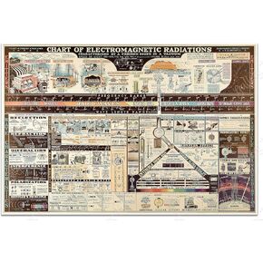 Chart of Electromagnetic Radiations by the W.M. Welch Scientific Company circa 1944 | Art Print Poster Vintage Wall Decor | 16 x 24 inches (406 x 610 mm) on Canvas
SAR 141
Chart of Electromagnetic Radiations by the W.M. Welch Scientific Company circa 1944 | Art Print Poster Vintage Wall Decor | 16 x 24 inches (406 x 610 mm) on Canvas
SAR 141