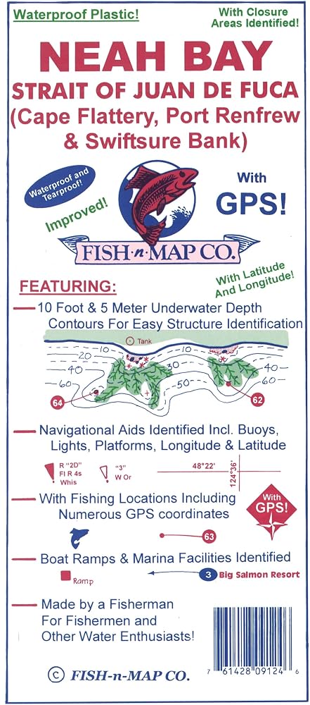
Chart is made of waterproof, tear-resistant plastic, opens to 2' x 3' and folds to 9" x 4" and is double-sided
10-foot and 5-meter Underwater Depth Contours
Navigational aids identified including Buoys, Lights & Platforms
Longitude and Latitude grids included with numerous GPS points
Rock Reefs, Submerged Rocks and Bottom Conditions displayed in detail
Fishing Suggestions with Fishing Locations identified
Fishing Strategy included
Fishing Restrictions identified
Facilities identified including Marinas, Resorts and Boat Ramps
MADE IN THE U.S.A.
وصف
Fish-N-Map Company underwater topography maps are printed on a waterproof, tear-resistant material and are folded to 9" x 4". When opened, each map is approximately 3' x 2' in size and is printed on both sides. These maps feature waterproof plastic "paper"; underwater depth contours; fish locations; latitude and longitude for GPS; often multiple lakes on one map; boat ramps; recreational facilities; and much more. 2018 AND 2024 UPDATES: SALMON AND BOTTOMFISHING FISHING RESTRICTION AREAS UPDATED Added Fish Habitat including weed beds and rock rubble reefs Added onshore trees Updated New Fishing Locations & Fishing Strategy Updated facilities including Marinas, Boat Ramps, Resorts and Roads Updated Shallow Shoals Added a new color: green Added additional kelp beds Updated facility information and roads
 خريطة Fish-N-جزر سان خوان
SAR 81
خريطة Fish-N-جزر سان خوان
SAR 81